Scouting for specks and reds may not be as fun as reeling them in, but it is a skill you must master if you want to keep catching as patterns change.
Catch Speckled Trout and Redfish by Fishing Reefs
The process of finding new fishing spots can be hard work.
Truth be told the reward of “finding your own fish” is greater than reeling them in. Any schmuck can reel in a trout, but can you find them? That is where the challenge lies.
This article will help you defeat that challenge by teaching you how to identify reefs speckled trout and redfish hold to.
Do your homework before the fishing trip
The bird’s eye view and historical imagery on Google Earth reveal opportunities you cannot see at ground zero.
By doing your homework, you will know where you need to fish.
There are things you cannot see from your boat. A great speckled trout spot may be around the corner, but because it’s underwater you can’t see it.
I use Google Earth to “see” these potentially awesome fishing spots.
Google Earth is the Key
If you haven’t already, take the time to get familiarized with Google Earth.
Visit How to Create Your own GPS Routes to learn where to download it and how to use its features. It is a very powerful program.
If you listen to my podcast, then you know Louisiana’s best anglers use Google Earth to find the best fishing spots.

Note
You need to be using the Google Earth Desktop (program available for desktop and laptop computers). Google Maps and the apps for mobile devices do not provide the same functionality!
Remember, you can download the Google Earth program you need here:
Now that you’re familiar with Google Earth, go ahead and open it.
Set Hopedale, Louisiana (or where ever it is you fish) as your starting point. Every time you boot up Google Earth it will start out at this spot.
By now, you should know you can “rewind” and “fast forward” using the Time Slider to different points in time to view what the marsh looked like then.
Just look for a button that looks like this one:![]()
Google Earth has compiled various satellite imagery over the years. As you rewind and fast forward, note that some marsh on the outside has eroded away and that some marsh on the inside has stayed the same.
As experienced anglers know, redfish and trout love to stack on underwater structure, or reefs, the tide flows around.
This doesn’t always mean something big like a bridge or gas platform, but at least some kind of small change in the underwater terrain.
It can be a small hump only a foot taller than the surrounding seafloor. That little bit makes the difference!
Why fish these features in the first place? Speckled trout and redfish hold to these reefs because water flows around them, bringing bait their way.
It’s a predictable place the tide will always deliver bait.
How do we find these reefs?
They are everywhere, but usually not above the water where we can easily spot them.
This is where Google Earth comes into play. We will look at past imagery and compare it to present imagery to find where land has eroded.
Go to these coordinates in Fox Bay and look at the imagery from 1989:
29°57’53.57″ N 89°13’58.16″ W
You will see an island there along with a thin stretch of land that extends to the northeast. Now fast forward and note how the land is eroding away.
As it does, it goes underwater and creates a reef for fish to use.
Now you understand how to discover these “lumps” that were once a point or island and are a reef today.
Instead of marsh hens and nutria walking on them they now have speckled trout swimming around them!
An added benefit of finding these reefs
What’s great about these “unknown” fishing spots is that there is nothing to mark them.
No rigs, no beaches, no islands.
Nothing that screams to other boats “Hey! Come crowd this guy’s fishing spot!”
Another Example
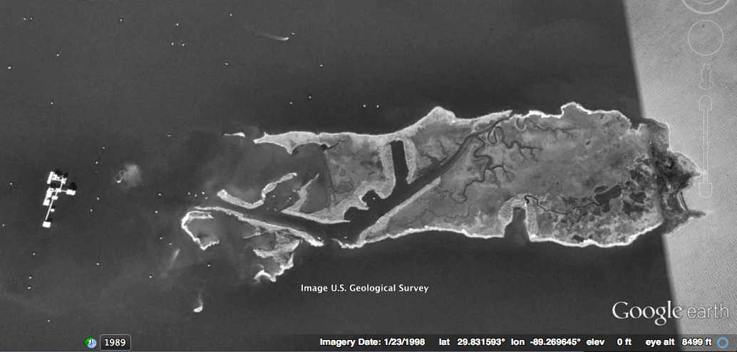
Check out this old island near Lake Athanasio. In the past I have caught many speckled trout here.
29°43’38.14″N 89°26’47.76″W

I found this old lump of an island using Google Earth.
When I went there in my boat, I was able to find it on my depthfinder. I even caught a few trout!
But it’s not always that easy.
Not every rise in the seafloor holds fish nor does every island continue life underwater as a reef.
Some just get flattened and no longer exist.
This is why it’s pertinent to find a lot of these points, mark them down and then make a route that hits all of them.
You may fish as many as 10 different spots to find a real winner.

Finding other reefs
You can also use Google Earth to find old gas rigs.
The platform may have been removed but the shell pad could still be there.
Take a look at Comfort Island at 29.825863° N 89.253829° W and see a platform on the west side of the island.
In 1998 you can clearly see the platform with all of its satellite rigs or “chair wells” around it.
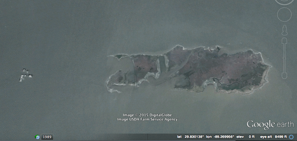
In 2007 you can see deconstruction of the platform begin.
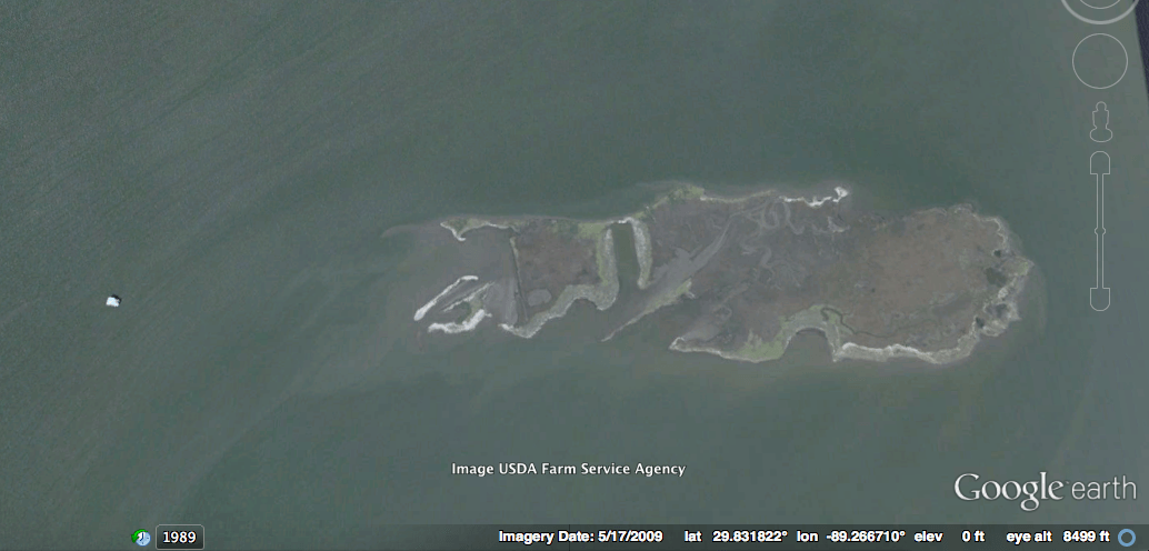
Fast forward to 2009 where it is nearly gone.
In 2014 we see that the rig is completely gone. But does the shell pad remain?
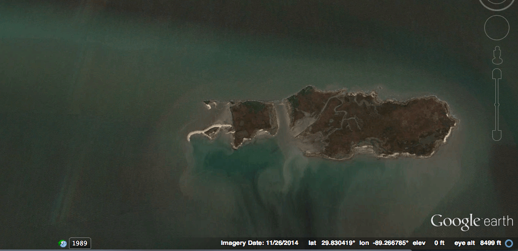
It would be worth your time to investigate! It could pay off in a big way.
How do you know if a reef is good?
When you catch fish there!
That’s an obvious answer, but it’s true. However, something not so obvious is how to treat new spots.
It is key to fish a reef over a period of time, and a mistake to fish it once and assume it’s no good.
Hit it up over several fishing trips, especially when the conditions are good.
If you don’t catch anything consistently, then chances are the spot is no good and not worth anymore of your time.