It's not a matter of "if" but "when" you will destroy your motor on a rock or pipeline. My luck finally ran out in this canal designed to kill lower units.
Boating Hazard in Venice, Louisiana
There is an update at the end of this article, be sure to read it.
Inshore fishing comes with its hazards. Thats why I like it, it's another dimension of the challenge of safely navigating the marsh to locate and catch biting fish.
Some of those hazards are underwater obstructions. These include pipelines, trees, stumps, oilfield trash, rockpiles, the list goes on and on.
If you spend enough time fishing, you will eventually hit something...
...and after you hit enough "somethings", you will eventually encounter one that destroys your lower unit.
It's just part of the game, sort of like how hershey-squirts are part of dining on Taco Bell.
So what happened?
On Friday September 29th my luck finally ran out.
I've always been good at avoiding underwater obstructions, because I find them beforehand with Google Earth or I slow down whenever I see anything suspicious at all.
So that if I do bump into a hazard, nothing is destroyed.
But on that day I was lured into a canal that could only have been designed to kill lower units. I swear!
There were no warning signs, nothing to mark the pile of rocks lurking less than a foot below the water's surface.
I flew across the rocks at ~35mph, striking them with the lower unit and getting the boat stuck on a couple more.
I knew the lower unit was dead. So when I trimmed the motor up it was to see "how dead" the lower unit was. See for yourself!
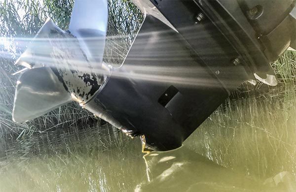
To summarize the rest of the story, we were able to get into open water in West Bay for Captain Nick Lapre of Southern Exposure Charters to retrieve us. We safely returned home with my boat in tow.
A good ending and a huge shoutout to Nick and Roger!
I am a SeaTow member and SeaTow was ready to come get me, but Captain Nick was closer and could get to us before the sun went down.
I highly recommend being a SeaTow member!
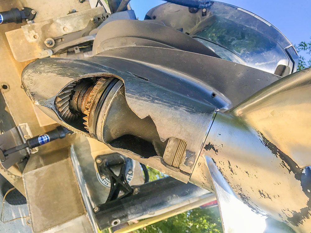
So where is this Canal of Lower Unit Death?
It's in Venice, between the West Bay Diversion and Mississippi River.
Coordinates are 29°11'45.02"N 89°16'58.66"W
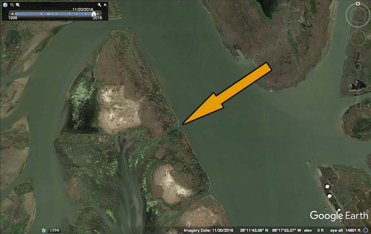
That canal is where I lost my lower unit. I'm certain the canal south of it is also rocked off.
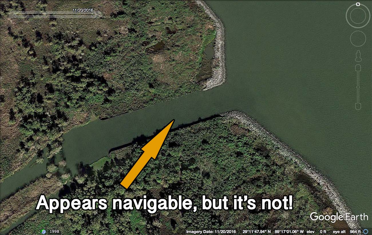
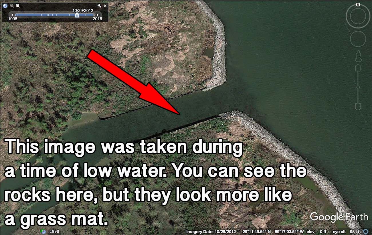
The canal appears navigable on a map.
There is nothing to betray the rocks strewn in it. Since nothing at all was marking their presence, there is no way I could have known. It's almost like this canal was designed to kill lower units!
Pass the Word So I am telling you, all of you, as many boaters as I can.
I would like your help in doing so, and you can help by sharing this article.
Why are the rocks there?
I have no idea.
My guess is the canal is part of the West Bay diversion project and the rocks were put there to prevent scouring of the channel's bottom. Otherwise, I have no clue.
If you do know, you can reach me here to fill me in.
Conclusion
It's not a matter of if but when you will hit an underwater obstruction.
The more time you spend running unexplored, shallow waters, the more likely your chances are.
Just understand that when your luck does run out, you should be prepared and have a plan.
Tight lines, y'all!
Update 10/6/2017
I got an email detailing more information about these canals:
Those canals or outlets were dug back in the 80's by the Corps as "mitigation" for bank stabilization (wire baskets of rock or "gabions") that was put along the river bank back then to prevent uncontrolled overbank flow.
They are the same concept as the deep cuts along the west bank of SW Pass where a lot of people fish.
They were built with funding from the Mississippi River Navigation Project before West Bay was conceived. They were designed to only pass fresh water, not sediment. So the bottoms of them are lined with big rocks and the banks reinforced with steel sheet piling to prevent scour and enlargement, eliminating having to maintain them.
I know this from working at the Corps for the last 29 years.
Also, someone else pointed out to me that there are two more canals north of the West Bay diversion that are also rocked off.
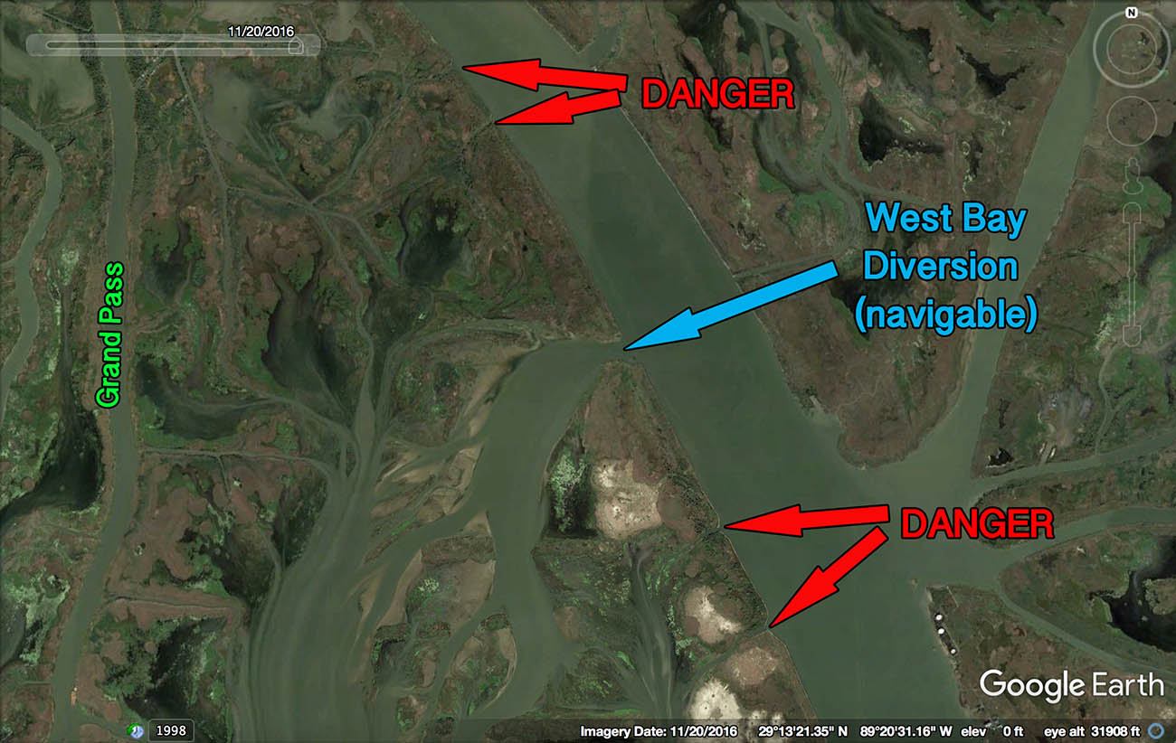
And some close-ups, for a better look.
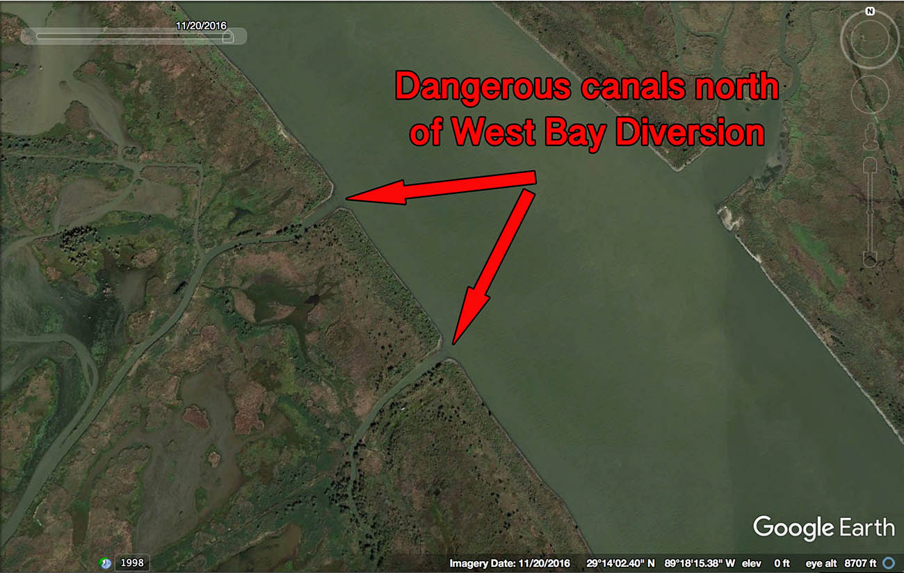
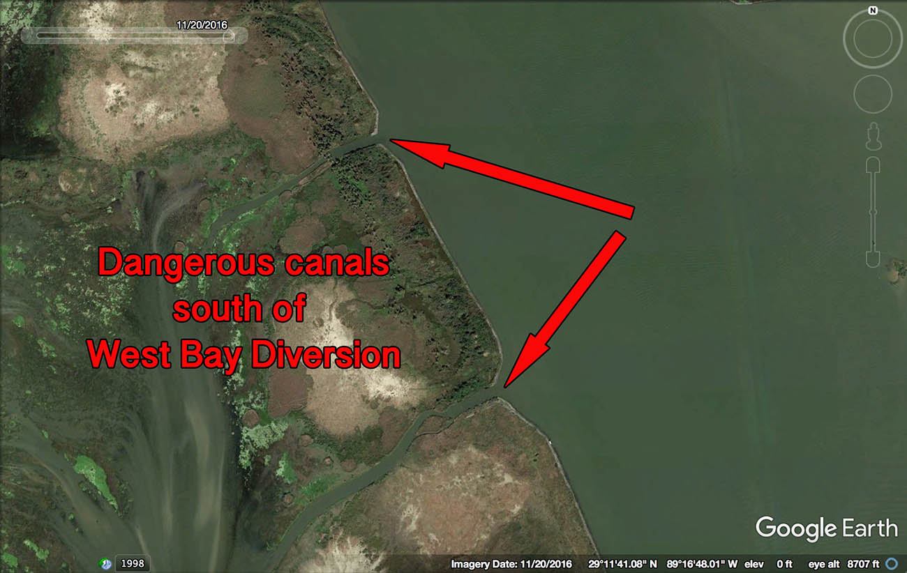
The coordinates for these underwater obstructions, from north to south, are as follows:
- 29°14'11.79"N 89°18'31.16"W
- 29°13'54.20"N 89°18'16.68"W
- 29°11'45.26"N 89°16'56.94"W
- 29°11'15.76"N 89°16'41.37"W
Stay safe out there, guys!
P.S. If you found this information to be useful, then consider signing up for my newsletter so you always know when I share new fishing advice.

Inside LAFB Elite’s flagship course, Inshore Fishing 101, you can learn the process I use to identify safe routes and navigational hazards, completely from scratch. This is how I am able to venture into new areas, catch fish and return safely to the dock.
Learn more here: https://www.lafbelite.com/join-lafb-elite/