Satellite imagery isn't displaying in your Lowrance, and it's really putting a hamper on your fishing fun. Here's how to properly install Standard Mapping E-Card in Lowrance GPS.
More...
If you made it to this blog post, then chances are your Standard Mapping E-card isn't working in your expensive Lowrance, so you probably just want to get down to brass tacks.
That's perfectly understandable, so let's do exactly that.
Be advised that these instructions are for a Lowrance non-touchscreen model.
The steps outlined below are, more or less, the same as with a Lowrance or Simrad touchscreen GPS unit.
(FYI, Lowrance and Simrad are both owned by Navico, and share similar software.)
Either way, don't be scared to poke around the navigation menus because –after all – it's just a GPS unit, and not a bomb.
Just being real.
How To Install Standard Mapping E-Card In Lowrance GPS
First and foremost, before we get started, let's be absolutely positive that your card is inserted all the way.
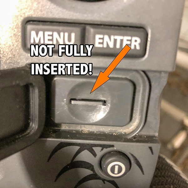
If your Standard Mapping E-Card is not fully inserted then all the steps below won't work in the first place to properly install Standard Mapping E-Card in Lowrance GPS.
Turn On Your Lowrance
Once it boots up, you will get a "don't do anything stupid" disclaimer.
Agree to not do anything stupid by hitting the Enter button.
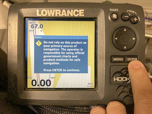
Then you'll be taken to your default screen.
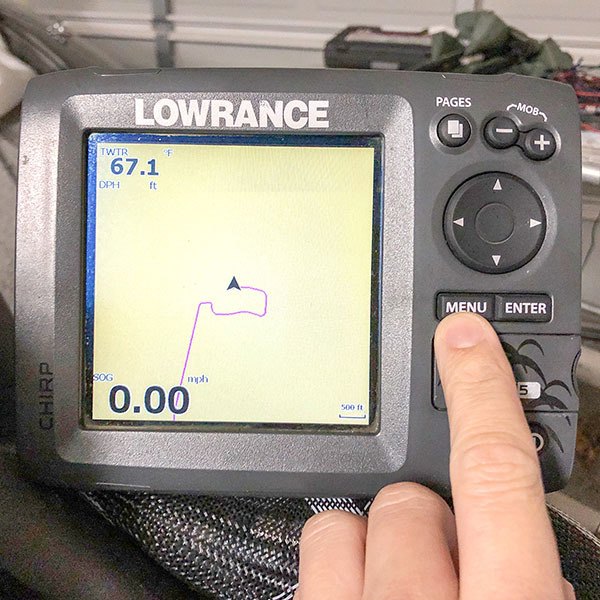
Understand that the GPS unit may need a minute to finish loading your Standard Mapping E-Card (even though it is not shown).
NOTE: For lower-end units (like the Hook 5 displayed), it is normal for the screen to freeze when loading the maps. It is part of the required steps to install Standard Mapping E-Card in Lowrance GPS.
Navigate To The Charts Menu
You'll do this by hitting the Menu button twice.
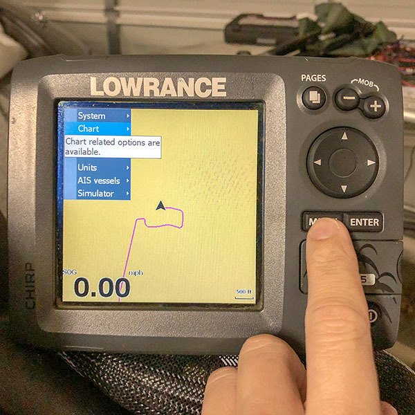
Open The Charts Menu
Now that you've navigated to the Chart menu, hit the right arrow on the keypad to open up that menu.
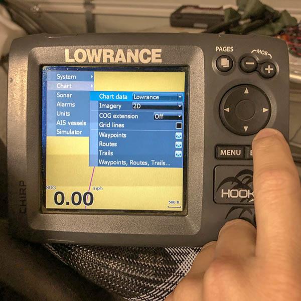
Select The Correct Imagery
Use the keypad to scroll down to Imagery, then hit Enter to select its options.
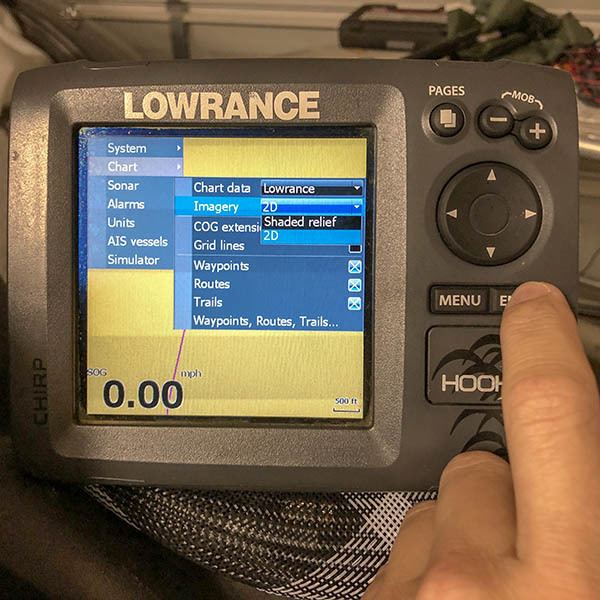
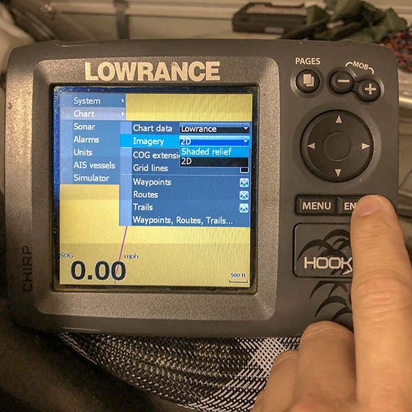
Activate Your Standard Mapping E-Card
Use the keypad to scroll up to Shaded Relief then hit Enter to activate the satellite imagery stored on your Standard Mapping E-Card.
Hang in there, you are almost done with your steps to successfully install Standard Mapping E-Card in Lowrance GPS.
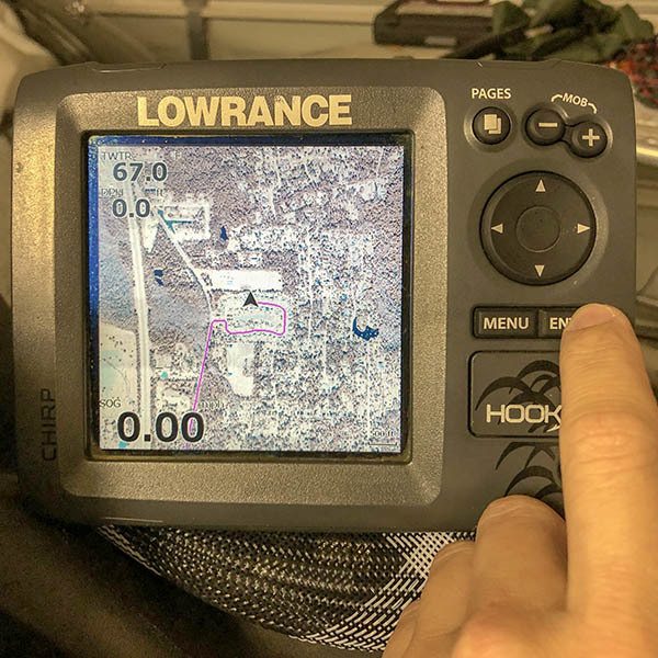
Enjoy Your E-Card!
That's it! You'll see the bland base map replaced by Standard Mapping's legendary satellite imagery.
If not, go over the above steps to install Standard Mapping E-Card in Lowrance GPS to see if you left anything out (like properly inserting the card all the way).
That's it, but there are a couple related items I'd like to bring to your attention.
For starters, you may read my review on this satellite imagery card here.
Secondly, I strongly suggest you consider the fact that a mapping card is not enough to safely navigate the marsh.
It cannot reveal shallow water like in this instructional video, or the underwater obstruction that killed my lower unit in Venice (yep, that's the carnage in the pic below).
If it were, I would havelearning how to plan routes in Google Earth.
the Questions? Comments?
Something to add to how to install Standard Mapping E-Card in Lowrance GPS?
Chime in below!

I’m sure that the steps for that unit are more or less the same, if it doesn’t occur automatically.
I’d ask inside LAFB Elite’s Community to be sure: https://www.lafbelite.com/forums/
Thanks for reading!
Great instructions…any tips on how to install the e-card onto the touch screen Elite-Ti2?
I have no idea. You’re better off asking inside LAFB Inshore: https://www.lafishblog.com/louisiana-fishing-reports/
Thanks.
Hi Devin, I have the same problem. On my new Hook Reveal 7 TS there is no imagery option. On my previous HDS unit the card was working well. Any idea?
I had ordered it from their website: https://www.standardmap.com/
Hope that helps!
Where as you get the standard mapping card?
My LA e-card won’t download on my Lowrance elite-7 hdi. My screen does not have imagery as a screen choice. Any ideas what I need to do ,,,,,,,,, thx
I don’t believe that it does. What model year is that?
Does the Standard Mapping E card work on Lowrance LMS 480?
100%! Thanks for commenting.
Thanks. The mrgo has many holes that the contour lines help to locate.
They’re not displayed at the same time, but you can switch back and forth between maps.
Do you lose the water depth contour lines when the LA 1 card is installed?