I recently went to upload a new YouTube video and, upon logging in, came across this inshore fishing gem. Apparently a couple fishing buddies had a navigational mishap and got a ride home with the Coast Guard. In this guide I'll detail what happened, what went wrong and — above all — what you can learn from their mistake, because there's more than one valuable learning point here.
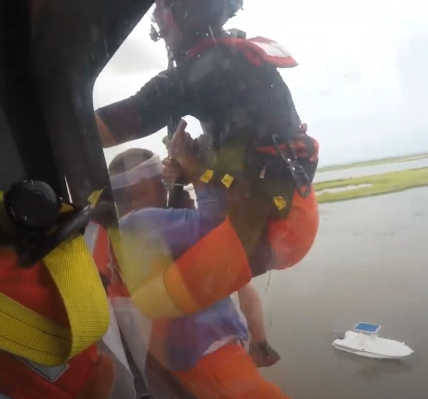
Yeah, no one plans for this to happen during their fishing trip.
But first I'd like to make a disclaimer about this valuable inshore navigation lesson...
In no way shape or form am I criticizing or throwing shade on these gentlemen.
First, they obviously had the character to document and share their mishap. This takes balls. You really have to be comfortable with admitting you f&%ked up in a public forum in order to do that, and they put this video on YouTube, the most public forum there is in the world.
Second, you can tell they were a pretty good sport about it the entire time. I'm not entirely sure who's at fault — because they're always saying it was the other guy lol — but when you watch the video you can tell they are having a blast on their unplanned inshore adventure.
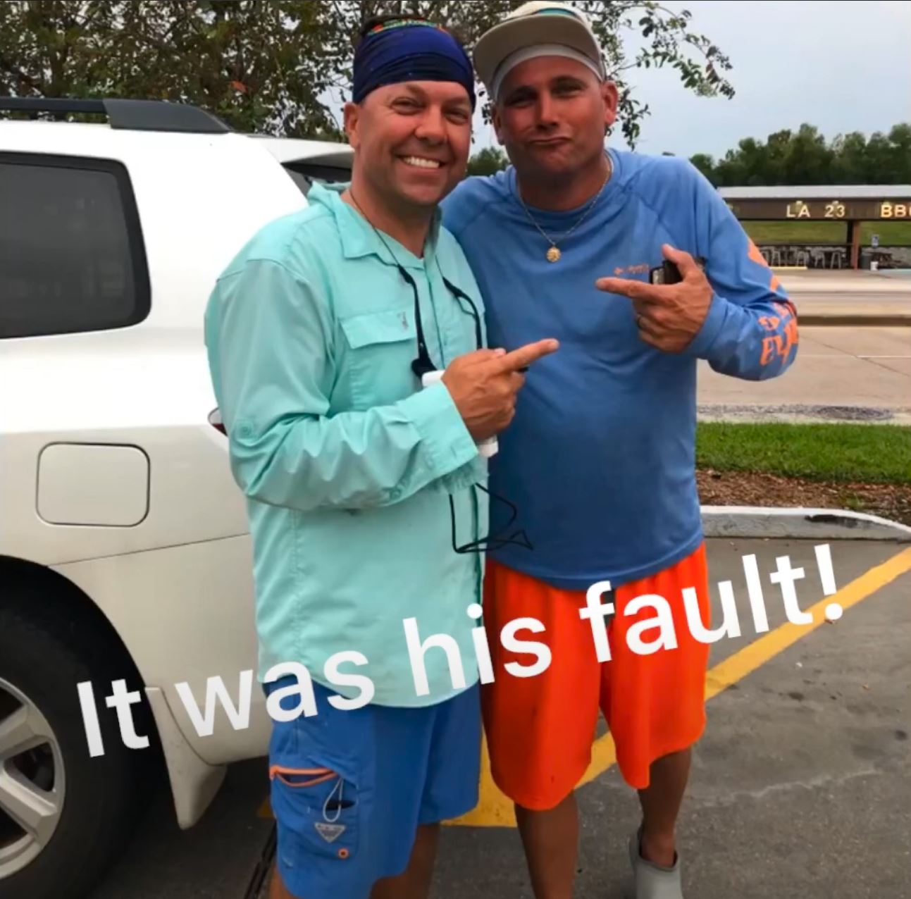
Two fishing podnahs for life!
Third, they took time to share where not to go, giving away the location of the navigational hazard. They could've left the rest of us in the dark, but chose to share instead. I have a lot of respect with that.
Last, but not least, nobody was hurt and they very obviously had a blast targeting Hopedale summer fishing spots, so that's great. With that disclaimer out of the way, let's look at where they got stuck then how it could have been prevented.
Where Their Boat Got Stuck (avoid this bayou)
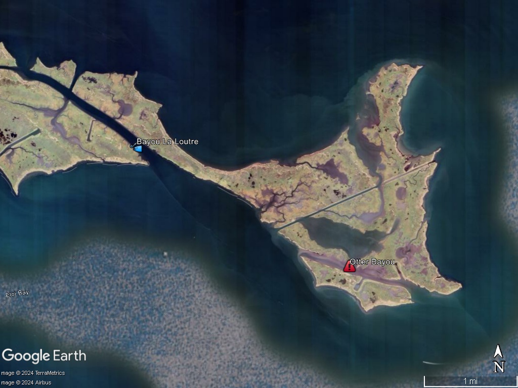
It turns out they got stuck at Otter Bayou, which used to be part of Bayou La Loutre many years ago before the southern shore eroded into Bay Eloi. If you didn't catch it, the word "loutre" is French for "otter".
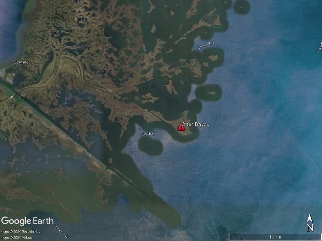
Otter Bayou can be found north of Bay Eloi out of Hopedale, Louisiana at coordinates 29° 46.107'N 89° 18.853'W
How They Got Stuck
I wasn't there and I didn't talk to them about it, but I can make a scientific wild-ass guess as to how this ordeal went down: they wanted to go somewhere and used a mapping card to get there. Mapping cards are the worst solutions to navigating Louisiana's coast for many reasons, so many that I am writing an entire article about it. So be sure to subscribe so you don't miss out, it's going to drop some bombs.
Getting back on track: the chief reason mapping cards suck is that they lead boaters to believe that hazardous water is navigable. This is most likely what happened here: they looked down at their mapping card, saw the color blue and figured the boat would make it. Wrong.
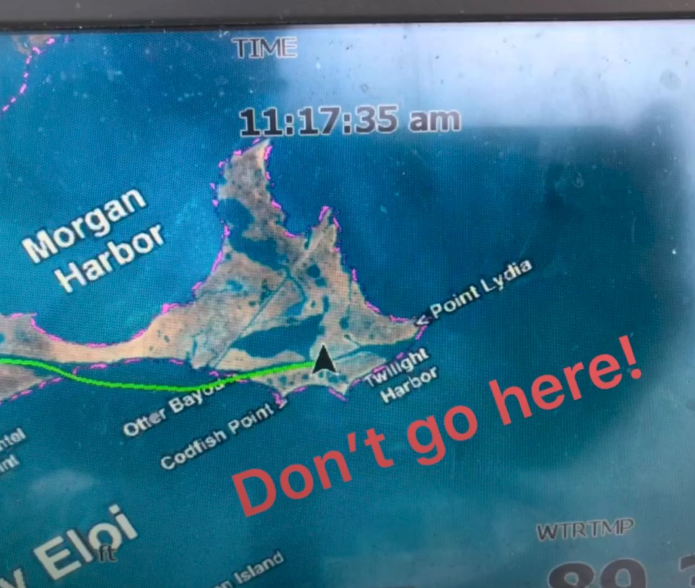
Taken from their video. Thanks for sharing, guys.
I have to admit, they made it pretty far. I'm impressed!
How could this boating accident been avoided?
Well, first off, that bayou is well known for being so shallow that it's best to go around it. But it's not like those guys had a crystal ball that magically reveals where all the hazards to navigation are. I didn't have one when I ripped off my lower unit in Venice. Everyone in Venice knew about those rock-laden canals but because Venice is not my homeport, I ran down that canal thinking it was safe.
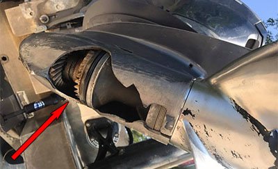
But if you saw my case study of that accident, you know that historical imagery inside Google Earth Desktop readily reveals the navigational hazard. It does so not only for that canal in Venice, but also Otter Bayou. Take a look at imagery from February 2020 and you can see obvious bottom detail giving away how shallow this body of water is.
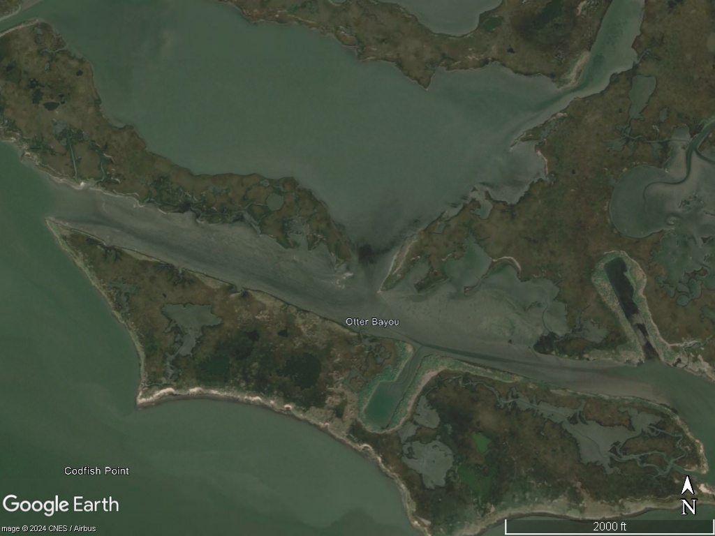
Even as far back as 1998 you can see that this bayou is silting in and that it's probably worth going around. This kind of pre-fishing trip homework is what I do before launching the boat, especially when going somewhere new. It's what I've used fishing from Biloxi to Slidell to Venice to Vermilion Bay to Big Lake and it's worked every time. The only time it hasn't is when I deviated from what was planned and began free-navigating off a mapping card. Huge no-no. Don't do that.
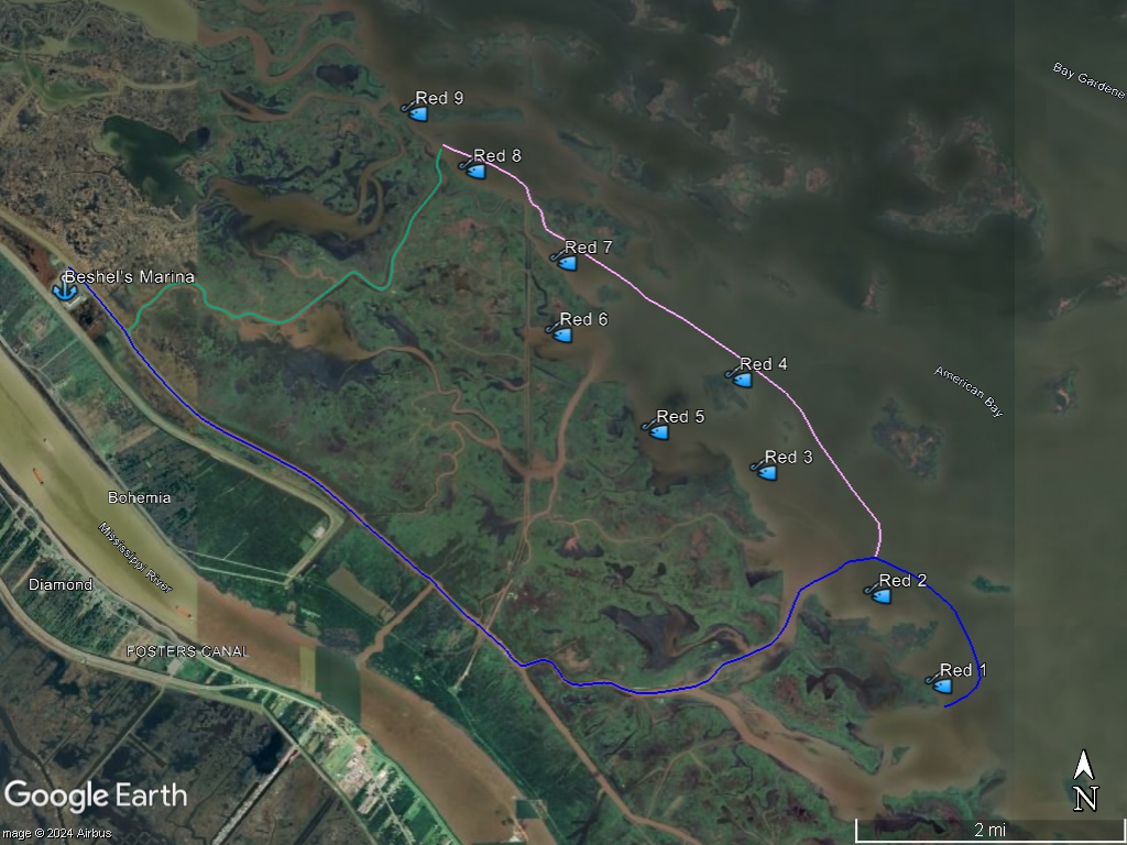
So, to be clear: if I wanted to fish that area and I had never been there, I would do my navigational homework on Google Earth Desktop and lay in safe routes for my boat to use, like what you see below for a redfish trip to Pointe à la Hache out of Beshel's Marina.
But there's more...
After that there's no reason to go in Otter Bayou. It's not a shortcut, it doesn't provide any lasting protection from the wind, and there are definitely better redfish spots to try.
Finally, one look at that bayou on a map and I would assume its silted in without even looking at more detailed imagery. There's no reason for water to flow down it, which would scour the bottom and keep it deep. This is "basic" knowledge of how water moves in the marsh, and I have an entire section dedicated to it inside Inshore Fishing 101.
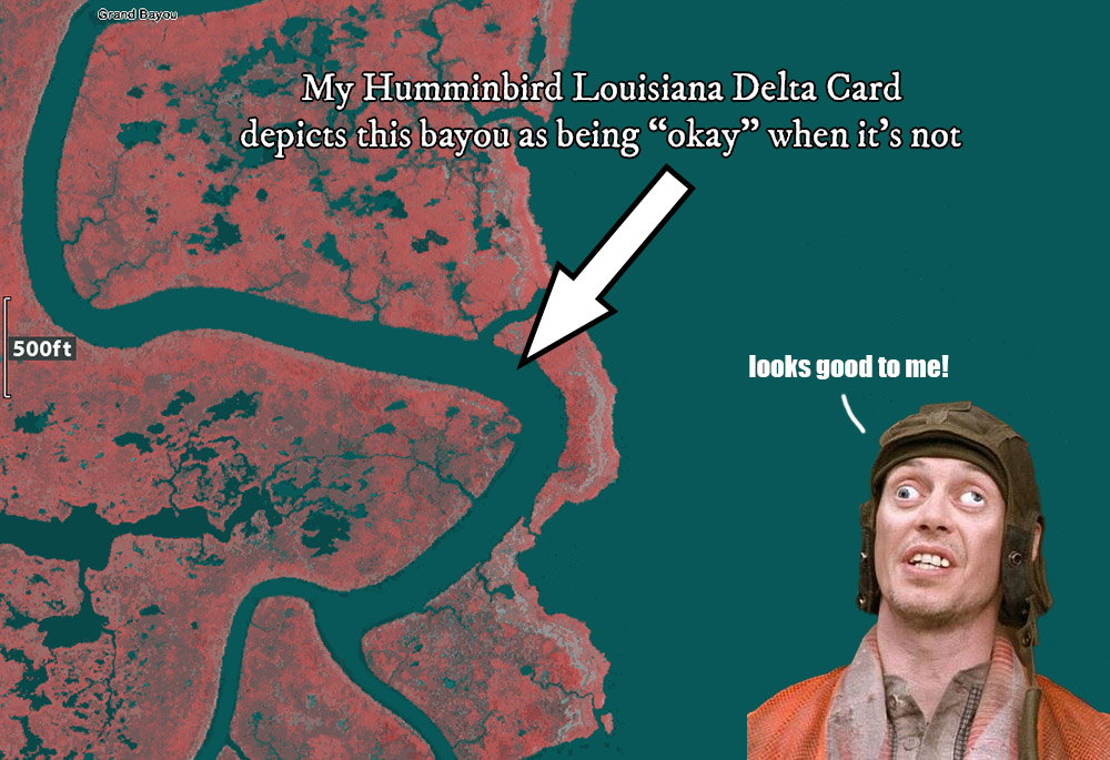
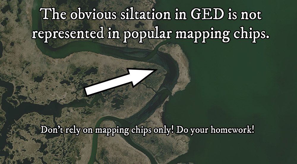
In fact, in my guide about finding deep holes for speckled trout, I detail how bayous silt in over time, with Grand Bayou in Lake Borgne being a great example:
Where you can learn all of my navigational know-how
As mentioned before, I don't fish just one area, I fish all over Louisiana's coast. Those experiences have taught me a lot of safely navigating to my fishing spots and back to the dock. It took my years to learn everything I know, but you can learn it much faster than I did because I've compiled it all inside my course Inshore Fishing 101, which is only available inside my membership LAFB Elite.
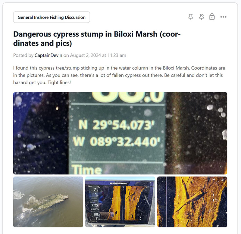
When you do join you gain instant access to the LAFB Elite Community, a forum specifically for members. We use it to share not just navigational knowledge of particular fishing areas, but also to help each other plan fishing trips and post fishing reports.
”
I'm a recent transplant from north Louisiana, and most of inshore fishing is brand new to me. I bought a boat last year and made a vow to learn as much as I can about the marsh, and feel like I've done just that!
I've bass fished a good bit so I have some basic knowledge and have been able to catch fish every time I've gone, just not numbers. I feel that this is taking me to the next level.
Time to catch a limit!
Steven Hinton / Construction
”
Devin's courses are easy to watch, and the delivery of each point in his lessons come naturally.
No one has a course like Inshore Fishing 101 that is more complete when it comes to speckled trout and redfish here in the state of Louisiana.
Brandon Robichaux / Rigolets Area Angler
A positive shout out to the Coast Guard and SeaTow
If you'd like to watch the entire video then please find it embedded below. When you do, you'll see the beloved and highly respected Coast Guard pulling off a flawless rescue, a fun helo ride and safe return of our intrepid heroes. Of course, a "stuck like chuck" story would not be complete without SeaTow executing a neat recovery of the stricken vessel. Thank you, Coast Guard and thank you, Sea Tow!
Questions? Comments?
If you have your own navigational tips to share, or maybe a question, then please post them below.
Tight lines, and thank you for visiting my website!
