You don’t need to sift through grandpa’s stuff in the attic. All the old Louisiana maps you ever wanted are right here, with a tutorial included.
More...
Pre-fishing trip planning has been key to consistently catching limits of speckled trout and redfish, and studying satellite imagery on Google Earth is part of that process.
You can see this process inside Inshore Fishing 101, but Google Earth doesn't always deliver.
Some erosion has been so rapid, or so far in the past, that what was once there cannot be found within the historical time slider.
This is when I turn to old Louisiana maps to gain a deeper understanding of the marsh.
Old Louisiana Maps Reveal The Past
I have found many places on the Internet that have old Louisiana maps, but none of them beat Old Maps Online.
Using this resource, I have been able to reveal the distant past.
Example
In Venice there are bodies of water (or land) with names that don’t fit.
Why is a pond called a pass? Or land called a pond?
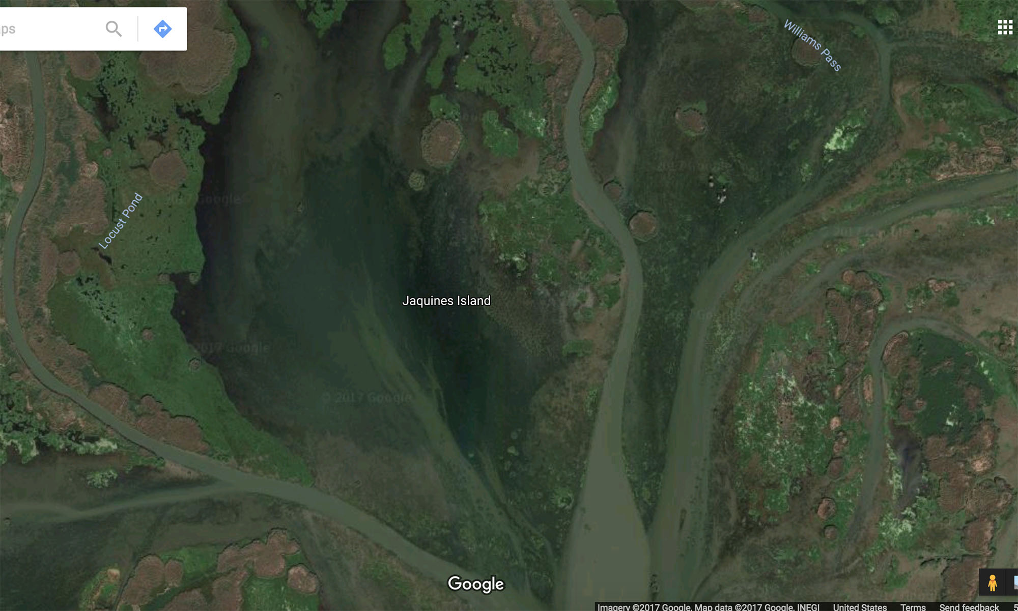
Take Jacquines Island for example:

Click to Enlarge
The above screenshot is from the most recent Google Maps satellite imagery, taken sometime in the last year or two.
The name is floating over open water, or at least very grassy shallow water.
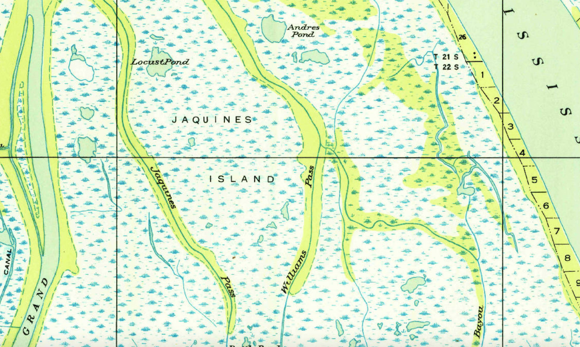
But, old Louisiana maps from 1949 reveal that it was a much larger body of land bordered by two bayous.

Click to Enlarge
How is this useful to inshore anglers?
First off, you may be a nerd like me and just want to learn cool, nerdy things.
Secondly, the satellite imagery in Google Earth only goes back so far.
So with these old Louisiana maps we can ascertain where points of interest once existed.
Chicot Island (near Shell Beach, Louisiana) used to be a great spot to fish, but coastal erosion wiped it out.
However, it may still exist as a reef.
Because it’s underwater, the exact location would be difficult to find, since the island isn’t visible on Google Earth.
Using these old Louisiana maps is one way of seeing if the island still exists underwater, and is a good place to fish (or not).
How do I use Old Maps Online?
Easy! Open a new window and navigate to Old Maps Online by clicking the button below.
And follow along with the video at the top of the blog post.
Questions? Comments?
Speak up in the comments section below. :)

Thanks, Mark! I’ll take a look later today.
You should try historicaerials dot com (It said I was spam typing it the right way). It has some really old aerial photographs from the 50’s & 60’s.