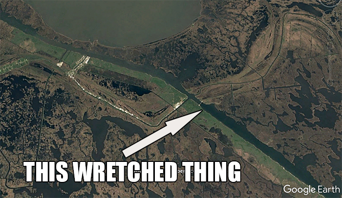
At first, you may not recognize this map.
The Mississippi River Gulf Outlet is a thing in St. Bernard Parish that could have been so much more but should have never been in the first place.
Its origins begin in the 1800s, when some "Good Idea Fairy" pitched the concept. At the time, it made sense.
The Mighty Mississippi was famous for shoaling up her mouth, making it difficult for ocean-going ships to pass. That, and navigating her twists and turns was equally strenuous.

The Mississippi River Gulf Outlet, MRGO or "Mr. Go", was planned as a shortcut from the Gulf of America to the Port of New Orleans.
It would be an easy, straight shot into the world's largest port without worry of running aground.
Even better, it would provide jobs for the people of St. Bernard. After all, it worked out for the Industrial Canal in 1923!
Sadly, only 700 ships used it each year.
That may seem like a lot, but when you consider that over 6,000 ships steam up the Mississippi River that number becomes miniscule in comparison.
The wharves, the dry docks, the warehouses...they never became a reality. The promises made to people who sold out their land, ecosystem and even part of their heritage were never kept.
Today, we are left with a freshwater swamp and marsh transformed to hardy spartina grass and detritus.
The saltwater marsh of St. Bernard is as productive as ever, but the MRGO sped up its death by centuries.
Today, storm surge is worse and land is disappearing at an alarming rate.
So how does this apply to inshore anglers?
We spend a lot of time looking at a map.
Not a paper map, but usually a more advanced mapping system such as Google Earth. We use Google Earth to find new fishing spots and create custom GPS routes.
I know I do, and I am accustomed to seeing that big, ugly canal going smack dab down the middle of a marsh that took millennia to build.
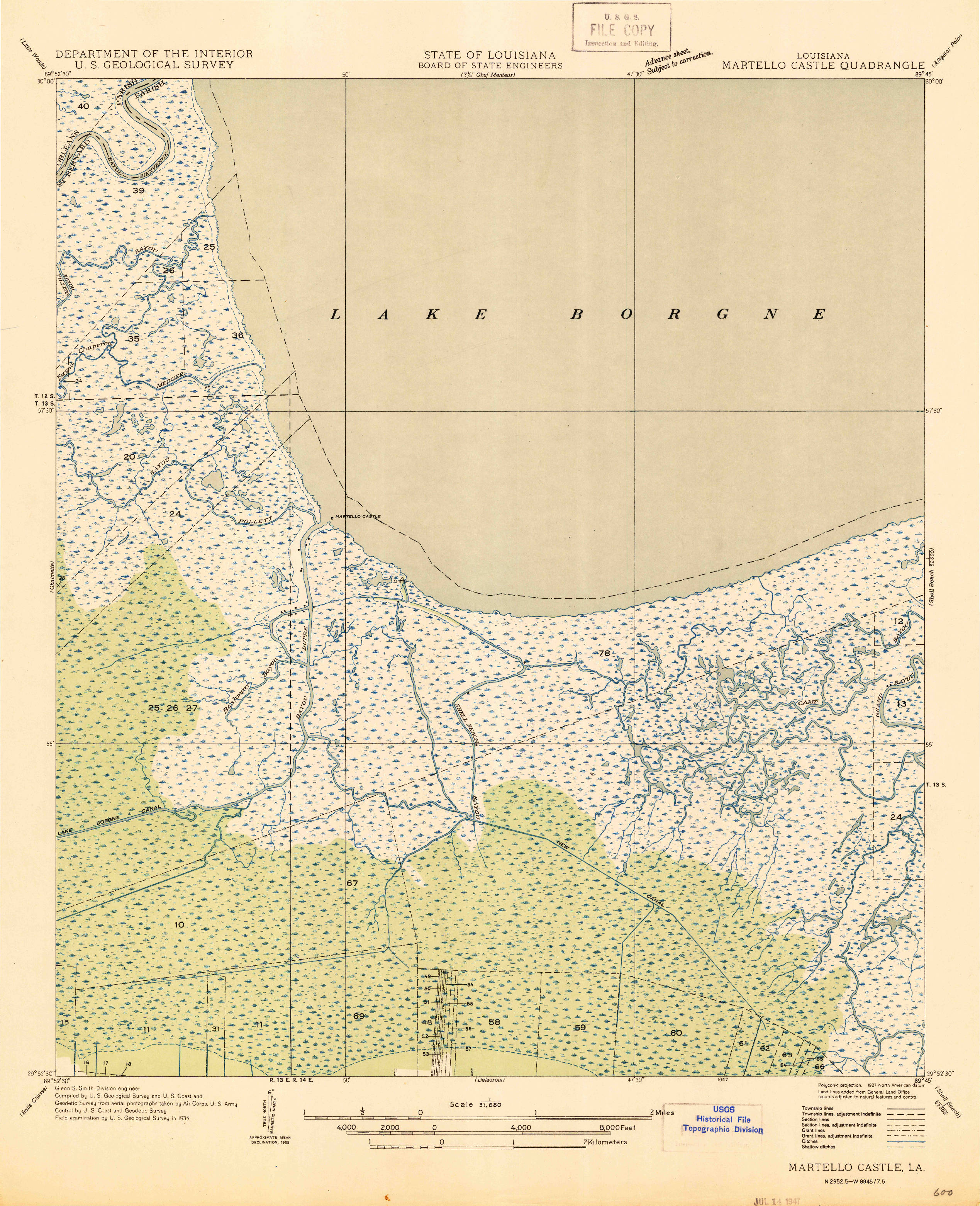
But check out these maps from the 1940s. See, construction of the MRGO began in 1957 and was completed in 1965. These maps were around for a decade or more by the time the MRGO was approved by Congress.
So, for me, it's a shock seeing the marsh without the huge canal there. In fact, it's interesting to see the bodies of water that were there before.
You will have to click the map to enlarge it.
Things to note
The road you take to Breton Sound Marina peters out just north of Hopedale Lagoon. It's my guess that area wasn't developed yet.
It's interesting for me to see Bayous Bernard and Pisana unmolested.
Here is another of Martello Castle from 1947.

Martello Castle 1947 - Click to Enlarge
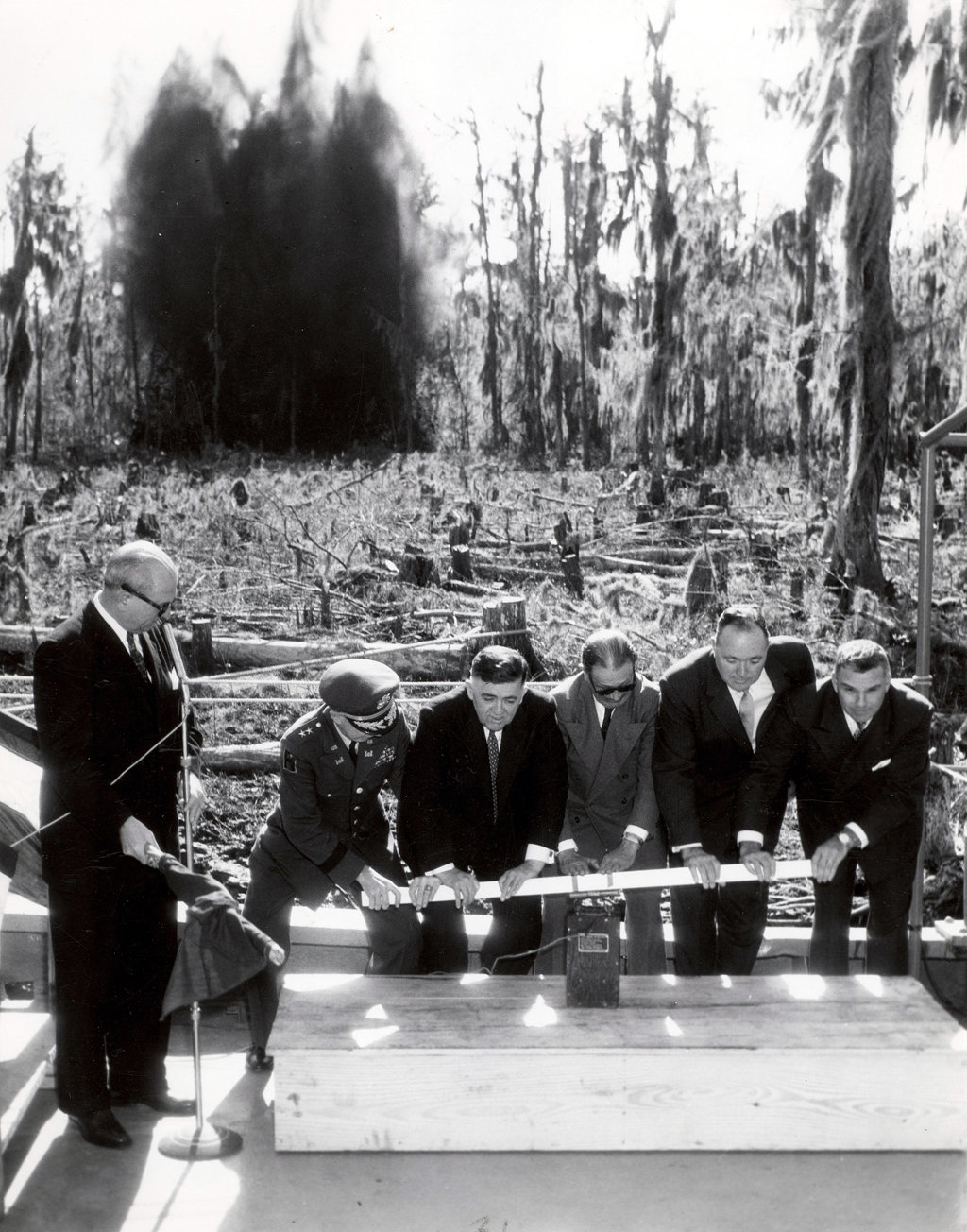
Think of all the marsh that would have gone unchanged if the MRGO was never built. Cypress trees are a rare sight in St. Bernard, at least compared to what it used to be.
Just check out this photo below of the groundbreaking for the MRGO in December 1957.

Click to Enlarge - Groundbreaking for the Mississippi River-Gulf Outlet was photographed in December 1957. From left are U.S. Rep. F.E. Hebert, Mississippi River Commission President William Carter; Dockboard president W.D. Roussel, Sen. Allen J. Ellender, Orleans Levee Board President Claude W. Duke, and Louisiana National Guard Adjutant General Raymond F. Hufft . (Photo Credit to Associated Press)
If that picture were taken today I would assume it's the Honey Island Swamp or Bayou Segnette. Never would I think it was in St. Bernard Parish.
Let these old maps serve as a reminder to make good long-term decisions for our marsh.
