One of the best things you can produce on your fishing trips are GPS breadcrumb tracks. The only thing that’s better is organizing these tracks for future use.
But yet so many people don’t do that. If you look at most chart plotters on bay boats, you will see the dreaded “black spaghetti”.
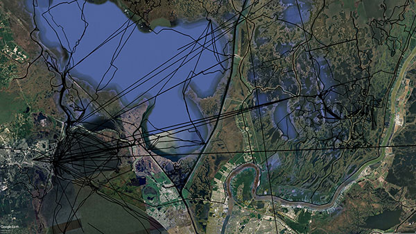
You can't tell where one fishing trip ends and the other begins! This is poor GPS data management!
So what is this “black spaghetti”? Why is it so awful? Why should you take better care of your GPS breadcrumb tracks and what are some tips and tricks to do that?
That’s what I’ll reveal to you in this guide. Let’s take it from the top with how we used to navigate the marsh:
The “Old School” Way of Navigating The Marsh
Back in the day, it was best to learn the marsh the same way you learned your neighborhood: like the back of your hand. This was slower and took time, but was overall the best way (and arguably still is).
Electronics just weren’t what they are today: they were clunky and unreliable.
In the early days of GPS, there were no graphical user interface or map overlays. It was just a screen displaying the coordinates of your current position.
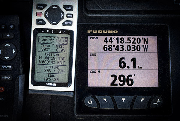
These were a boon back in the day. Today, 99.99% of inshore anglers have no idea what these numbers mean.
You would use this information to see exactly where you were on a map. Like, a paper map.
In the past, if you wanted to locate your position on a paper map, then you had to figure that out using something like terrain association or shooting a resection with a lensatic compass.
You also wrote this stuff down, on paper.
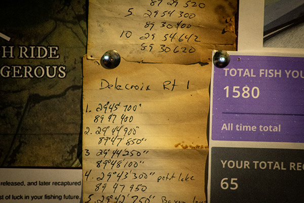
Yeah, I've been doing this inshore fishing thing for a minute.
Terrain association and shooting resections aren’t always viable in the marsh because it mostly looks the same and rarely are there landmarks to use.
So those old-school GPS units were handy for figuring out where we were in relation to everything else. But it was still slow and clunky.
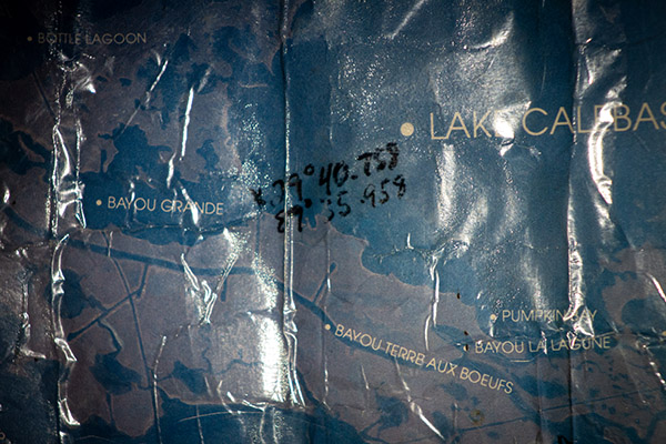
Of course, this is what you used if you weren’t familiar with the area you were fishing. I know that, growing up, we just learned the marsh and simply knew where we were.
But, if we wanted to venture out to somewhere new to us like these summer fishing spots in Venice, then we were relegated to taking it slow, using a map and — when needed — whipping out that clunky GPS.
This contrasts with what we have today: a “simple stupid” technology anybody can use to navigate a completely new area on the fly, with no paper.
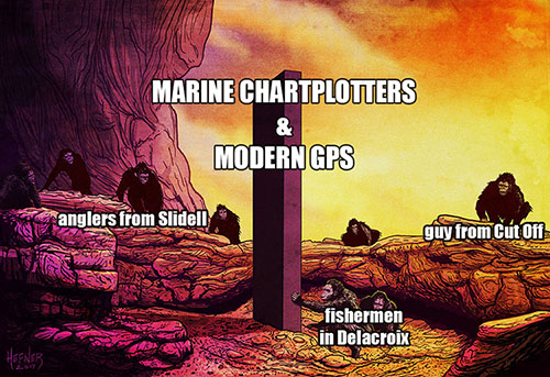
The technology making this even easier are those handy dandy GPS breadcrumbs. But what are they, exactly?
What are GPS breadcrumb trails?
They’re the GPS data showing where that GPS unit has traveled and, by extension, where you have traveled.
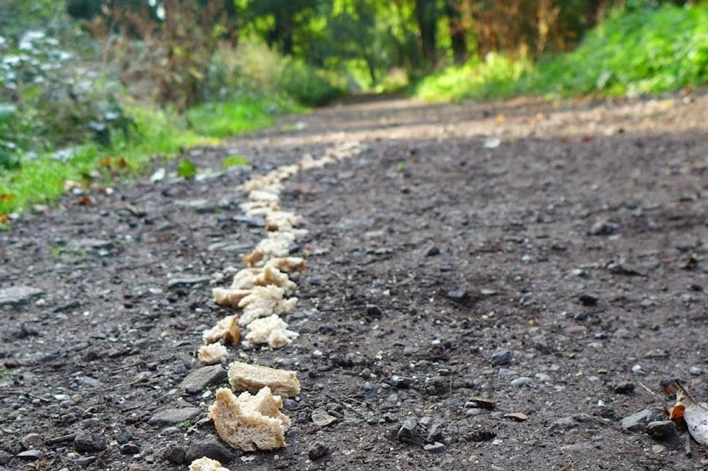
It’s a trail of “breadcrumbs” being left behind everywhere you travel on that GPS screen, not unlike the breadcrumbs used by Hansel and Gretel to see where they’ve been in the forest, which is where this term is borrowed from.
How GPS breadcrumb trails are useful for inshore fishing
In the event you get lost, you can always use these breadcrumbs to backtrack where you came from. No matter how much you screw it up, so long as the boat isn’t stuck and it’s running, you can always double-back or even return to the dock if you need to.
That’s the first way they’re useful. Another way they are a boon for inshore anglers like you and me is that they show where its safe to run.
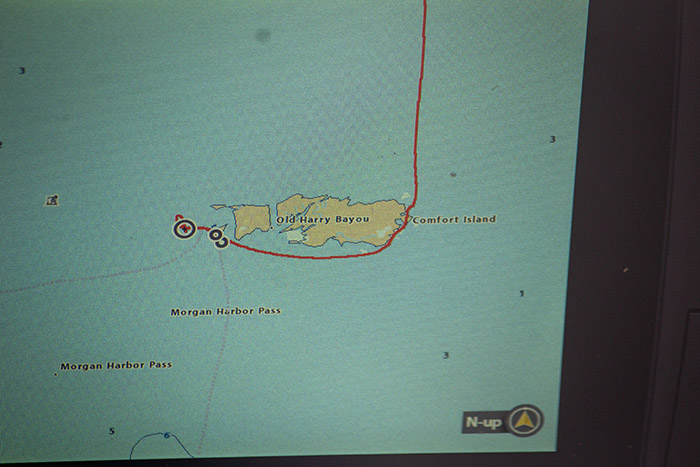
GPS breadcrumbs can even show where you’ve fished, as you’ll see more data show where you slowed down and checked something out.
This may not be such a big deal if you’re always fishing the same spots and running the same routes. I get that.
But if you’re a serious angler who enjoys the challenge of patterning new areas, then these GPS breadcrumbs are doing a lot of heavy lifting for you. You don’t have to memorize the area or figure it out all over again.
But if you never save them, the GPS will keep running, its memory will get full, and all you’ll have left is black spaghetti adorning your chart plotter.
Which is why I’m mind boggled to see anglers — even so-called “pro” fishing guides — not take care of them at all!
Why You Want To Save & Organize Your GPS Breadcrumb Tracks
The first and most obvious reason you want to save and organize your GPS tracks is for future use.
Eventually, at some point in time, you will want to run those tracks again, and that’s a lot easier to do if they’re not gone or difficult to distinguish in the black spaghetti.
The second reason is that your GPS will run smoother. It’s ability to do its job is a lot easier when it doesn’t have a bagillion tracks from years past to display all at once.
The third reason is that navigating is smoother when you can enable a track you want to run without being distracted by all the other tracks you don’t need, like if you wanted to get down Bayou Gentilly (especially before its shoreline was restored by CPRA).
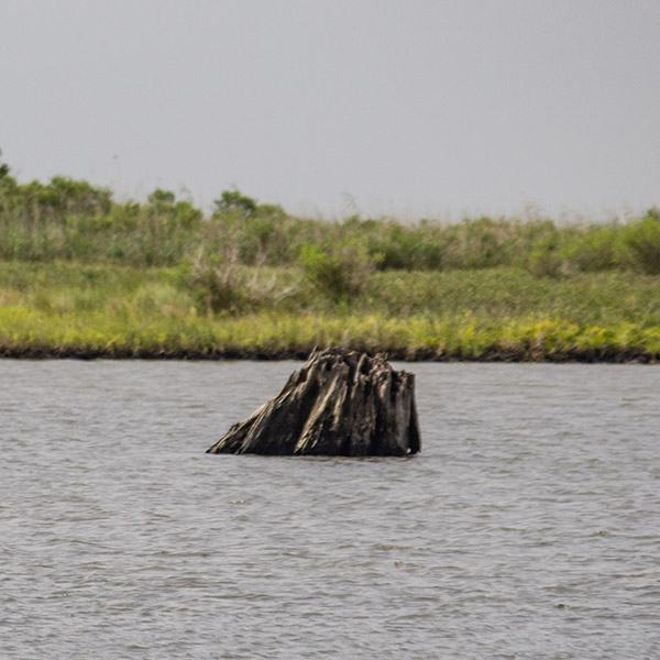
How are you going to remember where this stump is if you don't take care of your GPS data?
After that, if your GPS ever gives up the ghost (because that never happens), or if you get a new one and want to transfer your tracks, then you’ll have them ready to go. If not, good luck transferring that giant string of black spaghetti. It will crash your computer and be a nightmare to deal with.
Furthermore, if you keep each fishing trip’s GPS tracks separate and unique from all the others, you can upload them to Google Earth Desktop to see where you’ve been in relation to historical satellite imagery and learn the area you’re fishing a whole lot faster, or keep them for planning future fishing trips.
At the end of the day, patterns repeat themselves, and you can easily reference where to fish when the time is right, if you have those tracks organized and ready to go.
Why The Black Spaghetti Is So Awful
You won’t get any of the benefits mentioned above, because you have one long GPS track where you can’t tell the difference between yesterday’s fishing trip, last week’s or last year’s.
What You Can Do To Avoid Black Spaghetti & Protect Your Precious GPS Tracks
So now you know what to do, but how do you do it? Well, the first thing you can do is save your track at the end of each fishing trip.
How this works depends on your make and model GPS, but on my Humminbird Helix 12, the track is saved as the date and time it was made. This has also been ,more or less, my experience with Lowrance, Simrad and Garmin.
The silver bullet is to use Navionics Boating App. This is much easier to work with because you can email yourself the day’s GPS track in a .GPX format and back them up on the app.
After that, I recommend getting home a little earlier to offload GPS tracks and store them on a desktop computer with a personal fishing report, where they can be easily found and accessed for later use.
Next, you should ensure good voltage gets to your GPS unit. If you don’t, then your tracks could get lost during a voltage drop.
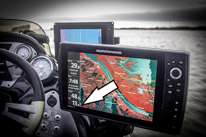
The very last thing: I go a step further by making my GPS units removable so I can bring them inside my office.
This is good for several reasons: I can work on my GPS data in the comfort of my home, there’s the added security of bringing the GPS inside where it’s safe from prying eyes or thieves, and there’s no walking back and forth from the garage to the office.
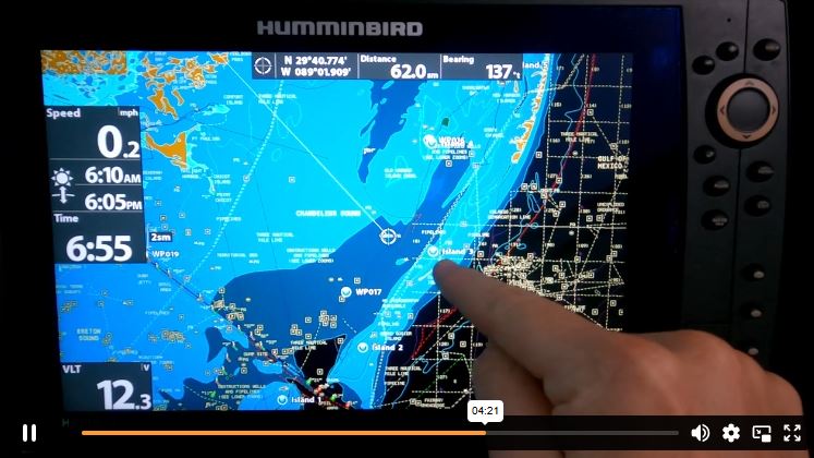
This screenshot from my HumminbirdPC course shows my Helix inside the comfort of my office, allowing me to easily work on GPS data.
NOTE: I do a lot of homework on Google Earth Desktop, choosing fishing spots based upon the predicted conditions and discerning safe routes to get to them, all in conjunction with my GPS breadcrumbs from previous fishing trips.
To facilitate this I use RAM mounts and have a 12v converter and power plug for my GPS units. This is also helpful as I have two boats and I can bring a GPS unit from one to the other without a hassle.
The End Result + Where To Get GPS Help
If you can do these things then you’ll have safe routes and fishing spots for years to come without risk of losing them to time, negligence or damaged electronics.
That’s what I’ve done for myself and I now have GPS tracks ranging from Biloxi, Mississippi to Slidell, Louisiana, on down to Venice, across Grand Isle all the way to Vermilion Bay and even a few in Big Lake. Specifically, right now I am learning Venice and keeping detailed reports, and saving each day's GPS tracks and organizing them is key to my long term success in that rewarding — but challenging — epic fishing destination, like what you see below.
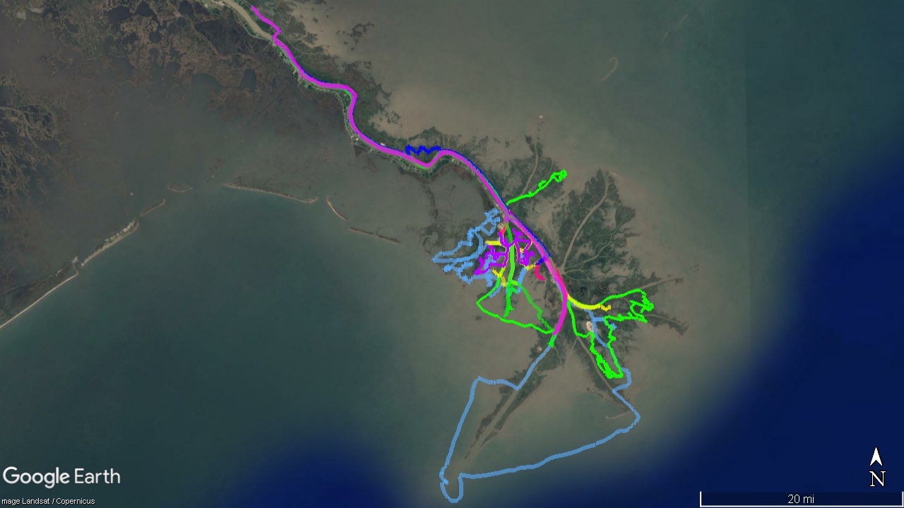
Here you can see the color coded and organized GPS tracks that I have ready for fishing Venice!
If I didn’t do this, then that data would have eventually been lost when certain GPS units bit the dust, or were swapped out, or whenever the memory eventually filled up and I would otherwise be forced to delete the black spaghetti and start over.
But what about your specific GPS unit?
If you are running a Humminbird Helix, then know I have a course made specifically for managing GPS data using Humminbird PC. If you’re a member of LAFB Elite, then you will find it here at this link.
Inside Inshore Fishing 101 I show how to upload and download GPS data for Navico brands such as Lowrance and Simrad. You’ll find that course linked here. Or you can buy my book on Amazon, Boot State Specks.
After that, there are all kinds of makes and models and, unfortunately, I am not an expert on all of them. No one is.
That’s why I built the LAFB Elite Community, a place where serious inshore anglers can discuss their passion with like-minded folks.
There you can post which GPS unit you have and we can help you figure out the best way to take care of your breadcrumb trails.
This community is only available inside my membership, LAFB Elite, where you also get access to the courses mentioned above as well as the rest of them. This video details all the benefits you receive upon joining.
Inshore Fishing 101 is Convenient
I loved the easiness of going through Inshore Fishing 101, and that I could go back and redo a video lesson.
The content is outstanding! Devin is easy to listen to and follow along. His passion and knowledge of our fabulous fishery is something everyone that wants to better their game should consider.
I have done my best to transfer my knowledge of the marsh to my grandsons. They will watch Inshore Fishing 101, at a minimum.
Leo Damaris
Grandfather
Excellent Experience
Inshore Fishing 101 is amazing, I’ve been able to add to so much to my knowledge base after completing it.
The way Captain Devin breaks down fishing concepts so they are easy to understand, as well as the optional quizzes, I was able to learn a lot more about finding and catching fish than if I were to watch YouTube videos or read magazines.
Very well done, Devin!
Terry Abreo
Best Investment I've Made
Yep, Inshore Fishing 101 is the best investment I’ve ever made in catching fish. (Keyword CATCHING)
I was an early member. I think if for some reason I lost my membership that I would buy another one!
I have been unsuccessful at finding anything like Inshore Fishing 101 anywhere else.
Thanks, Devin!
Michael Boleware
Mississippi Angler
Over To You
So, have you become a victim of black spaghetti? Or do you have some method you’d like to share? If so, please use the comments section below.
Tight lines, and thank you for visiting my website!
