This underwater obstruction in Pointe Aux Chenes destroyed the boat's propeller, leaving us stranded. This is where the navigational hazard is located.
If you're subscribed to my email list then you already heard about this little mishap and perhaps even inquired as to its exact location.
So, if that was you, thank you for your feedback!
I'm more than happy to help out, and that's why I made this blog post as a response to all the requests that have been received, so enjoy!
Just Want The Location?
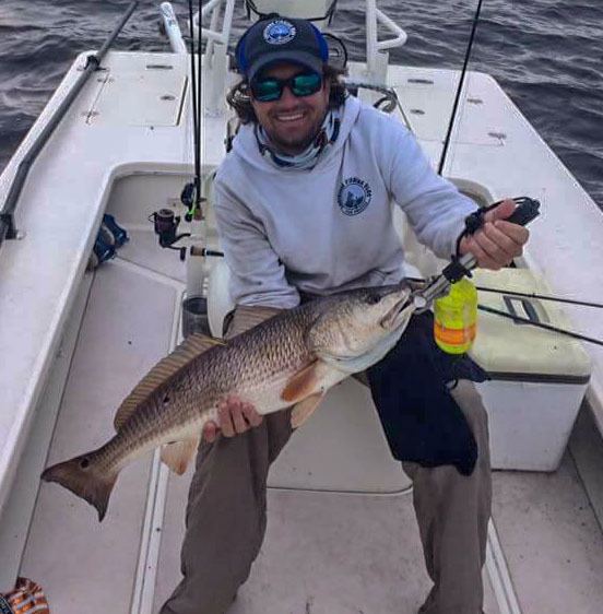
It was just another fishing trip to Pointe aux Chenes...
It was one of those days the wind laid down enough we could launch from pretty much anywhere, and go fishing...pretty much anywhere.
Those days I typically run "outside" where a rough sea state normally prevents a smooth ride, but instead we launched from Lafitte – not in my boat – but my buddy's flats boat, a sleek and quick Sterling 180TRS.
The idea was to target redfish, by sight fishing for them, and we wound up covering a good deal of water between Lafitte and Pointe aux Chenes.
But, the trip was bound to end, and end it did, in a way we had not planned.
Every inshore angler's worst nightmare must be an unmarked oil pipe, rock pile, or anything that deadly to a lower unit.
And that's exactly what we hit, several of them in a row. The sound of metal on metal was sickening as we came to a dead stop just inside Lake Bully Camp.
We weren't going anywhere fast! The prop was folded at the edge and the shaft bent so bad it shook the entire boat when put into gear.
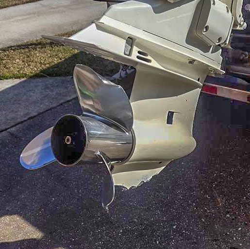
As bad as this fishing trip to Pointe aux Chenes seems, we were fortunate.
Firstly, because no one was hurt. Thank goodness!
Secondly, I had my SeaTow account (been a member for years) and this was the first opportunity to put it to use.
Not that I was thrilled to make the call, but SeaTow has an excellent reputation and it would be interesting to see how they were going to pull this off, with Pointe aux Chenes being so far from my "home water" east of the Mississippi River.
One phone call was all it took. SeaTow came to our aid!
That afternoon, we had the boat on the trailer and were headed home with one helluva story to tell.
Exact Location of What We Hit in Pointe aux Chenes
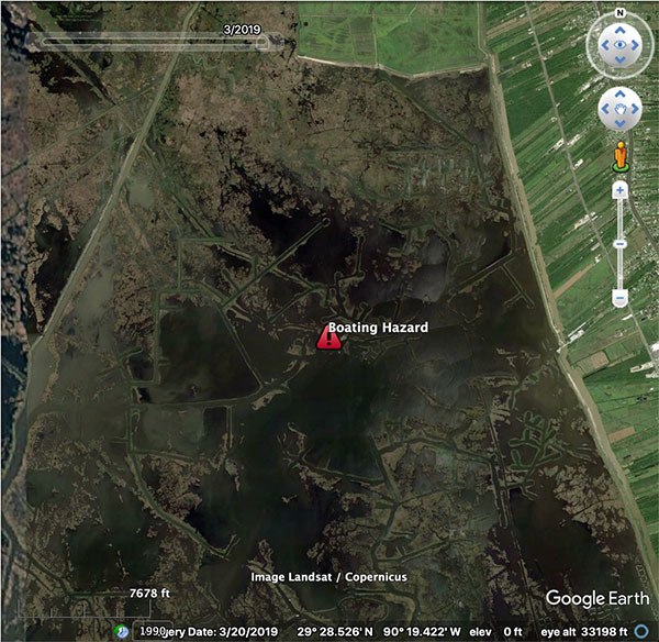
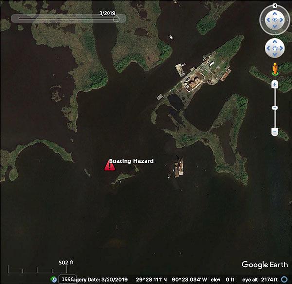
The coordinates for the boating hazard are:
29° 28.183'N 90° 23.049'W
Here's the location zoomed out:
And here it is zoomed in closer inside Pointe aux Chenes:
A Closer Look
And when we look at Pointe aux Chenes satellite imagery for 2005 it is clear that pipelines are running at or just below the surface of the water.
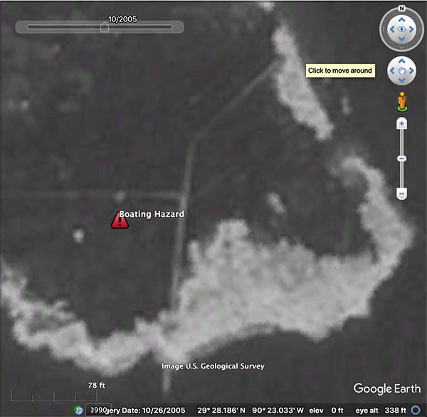
Sometimes these pipelines are reinforced with protective rock.
Take another look at the same spot in Pointe aux Chenes in 2015 and they are even more clear.
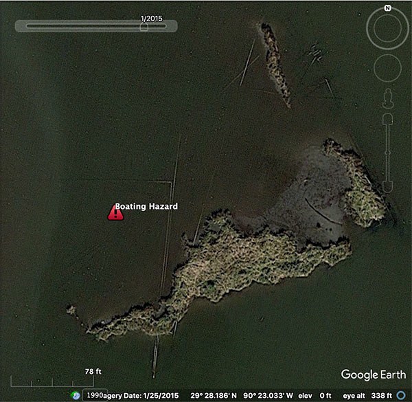
Learning Points
There's more than a few good points to learn from this experience, so let's cover them one at a time:
Sh*t Happens
First off, unexpected things are going to happen. This is inshore fishing in Louisiana, not golf.
It's okay if what happened to us in Pointe aux Chenes bothers you, because that shows you're a rational human being.
Just realize there are steps you can take to prevent such a catastrophe.
Do Your Pre-Trip Planning
If you've seen my case study of a similar boating hazard, then you know that underwater hazards like submerged rocks and shallow water can be spotted long before you launch the boat.
In fact, this is a cornerstone of what's taught in Inshore Fishing 101's module for inshore navigation.
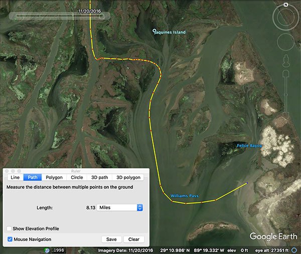
Detailed route planning like this is what you'll find inside Inshore Fishing 101.
I always do in-depth map studies of marsh that's new to me in order to prevent serious accidents (especially like this trip to Pointe aux Chenes).
This kind of homework greatly reduces the odds of striking something underwater, but does not completely eliminate them.
That brings us to this next valid point:
Leave a Lifeline
What will your loved ones do when you don't return on time?
What's the plan of action when the boat breaks down unexpectedly?
An acronym used in the Marine Corps is GOTWA, and this blog post breaks it down to help you plan for the unexpected.
Remember, it's not a matter of "if" but "when"...
Have Sea Tow
Having Sea Tow is having a great asset for when you have non-emergency marine assistance.
If you're unfamiliar with Sea Tow and what they do, then you really ought to consider these valid points.
Over To You
Have you fished Pointe aux Chenes before? What advice do you have for running the area?
Comment below!

Hey Terry, thanks for commenting.
Marsh Romance made by Hawk Soap Company is a great bug repellant.
What good for nats
Thanks Shannon, but that’s not Terrebonne Parish.
You could have called Terrebonne Parish Sheriff Office and Water Patrol would have towed you in free of charge. It’s a great perk!
Thanks for the heads up, Thomas.
Hi,
Just a FYI for the blog. The area near Billy Camp at Pointe Aux Chenes is an old sulphur mine. Back in the day when the sulphur mining ended, the well heads there where cut off and capped below the surface. Unfortunately, that land subsided, the area became open bay, and those subsurface well heads are now above the surface under the water. So, if you boating that area, be careful because there are water hazards all over the place.
Hey Jimmy, if I get time to do that I sure will.
Otherwise, it’s a pretty straightforward run down the ICW and is easily identifiable in the steps laid out inside Advanced Inshore Navigation: https://www.lafbelite.com/lesson/why-create-routes-with-google-earth-2/
Thank you!
Hey Devin,
I’d sure like to see the route you took to get from Lafitte to Pointe Aux Chenes.
Thanks,
Jimmy