Dredges are common in Louisiana, especially in and around the Mississippi River. There they are used to remove siltation from shipping lanes in order to keep the channel navigable for boat traffic.
But today we see their use more often thanks to coastal restoration efforts.
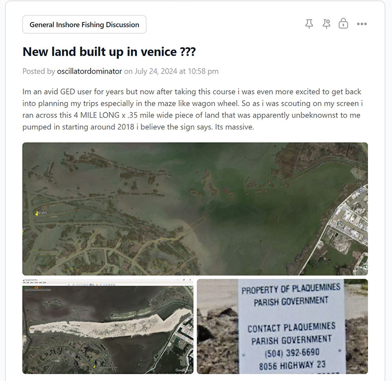
All across Louisiana’s coast, these large, floating machines have been used to rebuild land, from Cocodrie to Grand Isle to Venice to Shell Beach to Slidell.
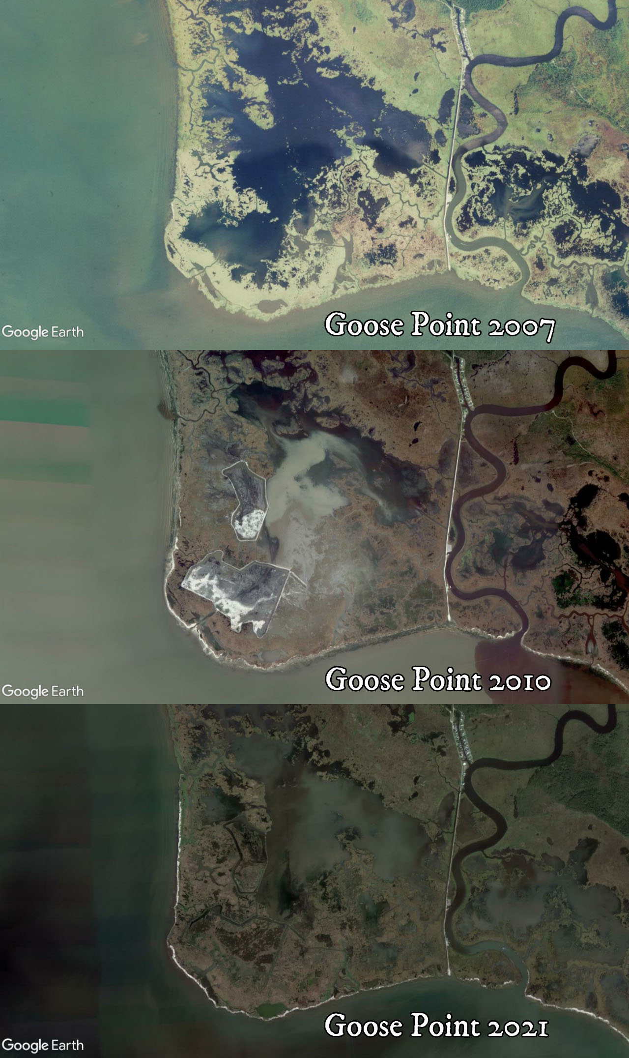
The above is Goose Point in Lake Pontchartrain near the mouth of Bayou Lacombe. The dredge operation there significantly strengthened this major point, protecting the interior marsh, Lake Road and the town of Lacombe.
If you've got Google Earth Desktop booted up and you're feeling froggy, then know that other places you can see successful land creation by the power of dredging include, but are not limited to:
- Shell Beach
- Grand Terre
- West Bay
- Isle Dernieres
- Yankee Pond
- Lafitte
- Venice
- Slidell
- and a whole lot more
You may not hear about it on the news and it may not be the most interesting thing on social media, but a whole lot of land has been rebuilt in Louisiana thanks to one form of dredging or another.
But the form of dredging in question here is hydraulic dredging.
This Coastal Restoration Performed By Hydraulic Dredges Sometimes Poses Navigational Risks To Boaters
Dredging has rebuilt a good bit of Louisiana’s coast, but the whole operation can pose a non-trivial navigational risk, especially to novice boaters who don’t have years of experience fishing across Louisiana’s coast and haven’t negotiated underwater dredge pipes a whole lot.
Well, it’s time to put an end to that! This guide reveals how these dredges work, the risk they pose to boaters, how to safely navigate around them as well as additional navigational resources.
How Do Hydraulic Dredges Work?
Dredges come in a variety of forms, but the one in question here is the kind that looks like a small or medium-sized building floating on a barge.
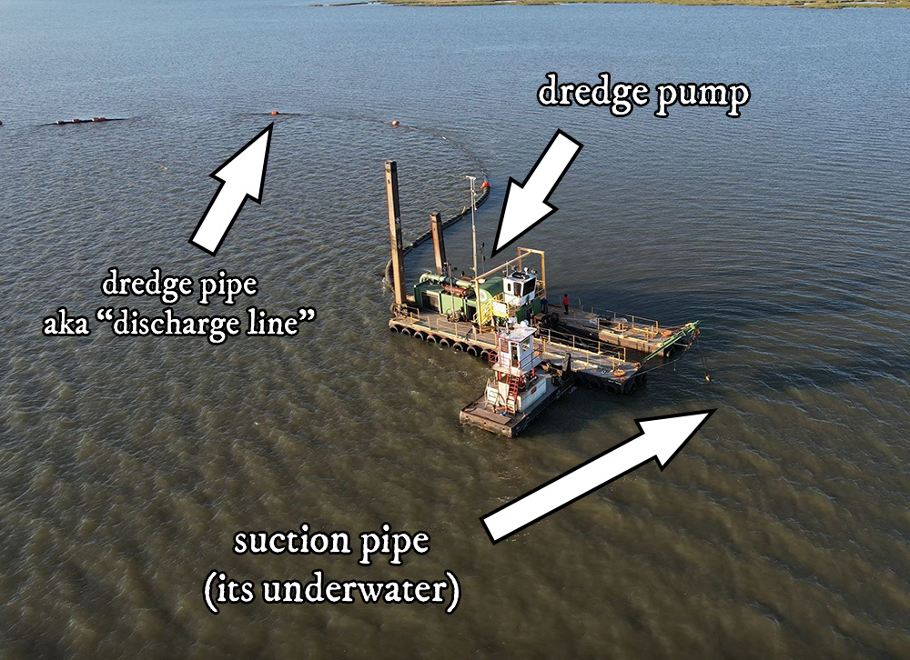
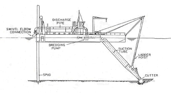
A suction pipe extends down into the water, where dirt is sucked up through the pump located on the barge, and is delivered through a much longer pipe running to the dirt’s destination on land, where there are usually excavators to spread the resulting spoil.
That Danged Dredge Pipe Is What Gets People
It’s almost always the dredge pipe that is the navigational risk to boaters. This could be because the pipe isn't fully sunk and on the seafloor, or because boaters run over the part they're supposed to avoid.
It doesn't really matter who's fault it is! If an accident happens at all then that's just awful, especially if kids or elderly are in the boat!
All it takes is a weekend joyrider looking at his phone then *bang* his lower unit is now resting on the sea floor. Bummer, dude.
Hopefully the only other thing hurt besides the boat is his pride and (hopefully) has SeaTow on the way to lend a hand.
So what could he have done different to avoid becoming a marine assistance commercial?
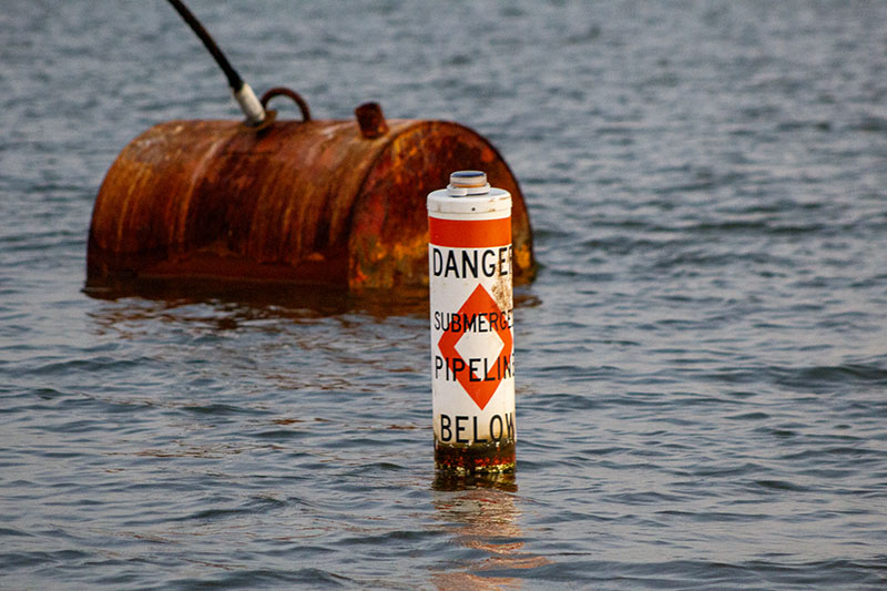
Dredge Pipes Are Marked With Buoys
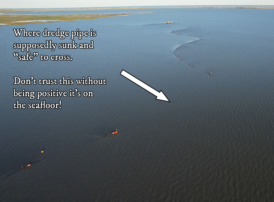
Anywhere you come across a dredge operation you will see a string of buoys marking the dredge pipe, like what you see in the picture below.
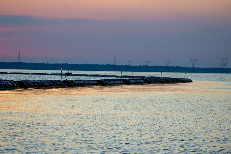
Sometimes these are floating the pipe, like what you see above. Other times they may be independent of the pipe. Either way, stay away from these buoys and you’ll avoid the dredge pipe. Easy peezy.
But what if you don’t see any buoys?
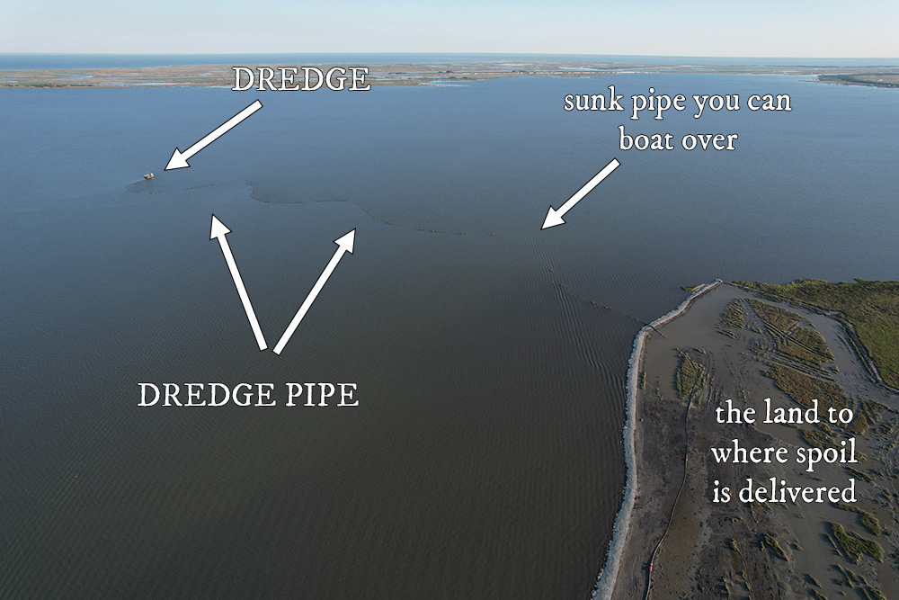
Now that you have an idea as to how these dredge operations work, the very first thing you can do is make the safe assumption that the dredge pipe is somewhere between the dredge and land.
Not in the atmosphere, not drilling to the center of the Earth, but in the water somewhere between the dredge and land. It’s not drifting amok and unmarked somewhere else.
After that, look harder, because the buoys are definitely there. In all the dredge operations I’ve seen across Louisiana’s coast, not once were these pipes not marked.
The Easiest Way To Avoid Hitting Dredge Pipes
Slow down and look. There you go. There’s your cheat code.
Here’s a question for you…
What is your hurry? Is someone in your boat bleeding to death? Well, you’ll get to the emergency room a lot faster if your lower unit doesn’t land on a crab in 20ft of water.
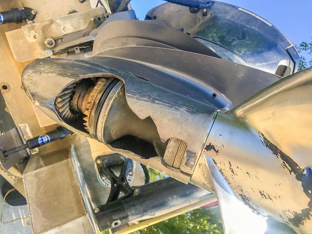
What's the hurry to risk something like this?
So my advice is to slow down, come off plane — well ahead of where the discharge line may be — idle cautiously, stand up and look for it.
If you have sonar, especially side imaging sonar, then look for it there to confirm it’s on the bottom, like what you see in the screenshot below.
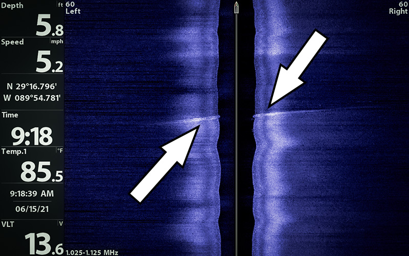
There's about 6 feet of water over this discharge line near Grand Isle. I put a waypoint over where it's safe to cross and used it later that day.
But what if there’s buoys marking a safe channel?
If you have to ask then your answer is, "Slow down anyway!" Again: what’s the hurry to rip off your lower unit or worse?
Bad things can happen, and I wouldn’t leave that to chance if there is a single iota of doubt in my mind.
Or Consider This Alternative
Just go around the thing.
By now you have an accurate mental picture of how dredge discharge lines are oriented in the water. If you’re unsure, or if the dredge operation is experiencing some kind of sorcery, you can easily avoid the headache altogether by simply going around the entire thing.
It’s not like you have to paddle your bay boat there, just run an extra minute or two and bask in the assurance that you’re doing the safest thing possible.
How To Know Where Dredges Are Operating On Louisiana's Coast
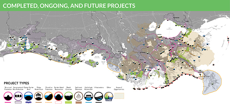
The Coastal Protection & Restoration Authority is responsible for a good chunk of the dredging you can encounter across Louisiana's wetlands.
They've accomplished a lot, have a lot going on and plan to do a lot more! All of it is detailed inside their 2023 Coastal Master Plan.
More Navigational Resources You Want To Prevent Accidents That Happen To Most Fishermen
While avoiding marked navigational hazards is relatively easy, what’s not easy is avoiding the unmarked ones.
If you can discover safe routes for your boat while avoiding the underwater hazards, then you’re free to fish anywhere on Louisiana’s coast.
This is a critical skill, because some places are riskier than others. For example, how do you know if a white PVC pole is marking a channel or something dangerous?
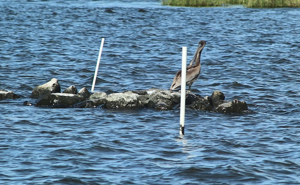
These rocks are barely visible when the water is low. When it comes back up, they'll be easy to overlook and lose a lower unit on.
This and more is what I teach inside the Advanced Inshore Navigation Module of Inshore Fishing 101, and what members of LAFB Elite Community share with each other inside our exclusive forums.
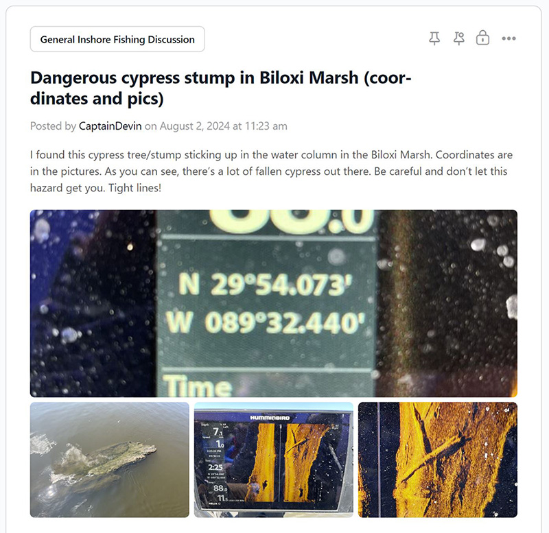
These features are only available to members of LAFB Elite. Interested to learn more? This video details the benefits of joining.
”
Yep, Inshore Fishing 101 is the best investment I’ve ever made in catching fish. (Keyword CATCHING)
I was an early member. I think if for some reason I lost my membership that I would buy another one!
I have been unsuccessful at finding anything like Inshore Fishing 101 anywhere else.
Thanks, Devin!
Michael Boleware / Mississippi Angler
”
I've been fishing Lake Pontchartrain since I was a kid and learned a lot inside Inshore Fishing 101.
What stuck out the most to me was presenting baits to fish. I got skunked many times until I learned how to do it the right way.
I love to laugh, so the humor you put in the videos was awesome.
It took about two weeks for me to complete Inshore Fishing 101. I've already applied things you taught me and have increased my catch.
Thank you, Captain Devin!

You’re welcome. Thank you for leaving a comment! It lets me know people are visiting and looking.
Thankyou Capt. D for this great info, Ive seen dredges but never knew exactly how they worked, now I will know what to look for!
Thank you so much. I appreciate you taking time to visit my website.
Very good information. Keep up the great work!