Because if you don't fish clean water then you are not Fishing Smarter.
Google Earth helps you find clean water after a nasty cold front hits
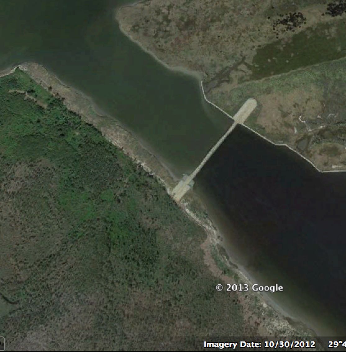
This photo is a snapshot from Google Earth.
Specifically, it is a photo taken of the Hopedale and Bayou Biloxi marsh right after our first big cold front hit at the end of October 2012.
To the untrained eye it is not readily apparent what is "clean" and what is "dirty" water. But this snapshot of the Rock Dam provides us with an awesome comparison.
Clean Vs Dirty
The southeast side is predominantly deep water that is protected from the rolling action of harsh west winds and low water. This is clean water. The other side (the northwest side) is a great example of dirty water.
Find More Clean Water
So now that you know this you can look at the rest of the area and get an idea as to where would be good to fish.
This means that any water that looks clean in this satellite imagery is probably deep water where speckled trout are holed up.
Don't Forget Tidelines
This also means you can see tidelines that are worth trying when the water has cleaned up. The tidelines are easier to see because the muddy water is acting like a "dye" that traces their movement.

For reports on where clean water is visit Louisiana Fishing Reports.
Finding clean water is Fishing Smarter. If you don't have clean water then you do not have a fishing trip. The above information is helpful but you should really tie it altogether by understanding how to judge water conditions.
Tight lines, y'all!
