Read Maps And Use GPS For Inshore Navigation to run the waters like a local who's lived there all his life
never get stuck in shallow water & always arrive safely to the honey hole
It pays to know how to read maps and use GPS for inshore navigation, especially in a place like Louisiana! Louisiana's coastal marsh is one of the most difficult places to navigate on the Gulf Coast, and for many reasons.
Things are always changing, with land giving way to shallow water, and land being built where deep water used to be, not to mention the oil field trash and underwater hazards that can disable your boat.
So what can you do? The blog posts in our "Navigation" category will help you read maps and use GPS for inshore navigation so you get to the honey hole and back without a hitch.
Got a second? Join my email list so you never miss a new blog post about how to read maps and use GPS for inshore navigation.

Will Collins
Avid Angler
As a native of the bayou I want people to come here, have fun and catch some fish! You can literally catch fish every day in Louisiana and I want anglers from out of town to be knowledgeable of a few of the tricks we have! Louisiana Fishing Blog provides those tips and tricks.
...or enjoy these blog posts about how to read maps and use GPS for inshore navigation:
Avoid Grounding Your Boat in Otter Bayou Like These Guys Did
Bayou Bienvenue Locks: How To Know If They’re Open Or Closed
How To Safely Boat Around Dredge Pipes On Louisiana’s Coast
Page [tcb_pagination_current_page] of [tcb_pagination_total_pages]
How i learned to read maps and use GPS for inshore navigation in louisiana's marsh
I think that my inshore navigation education began with my father, when he'd take me fishing.
We'd go to places like the Biloxi Marsh, where the terrain was very uniform: all grass and water that looked the same. There were no dominant terrain features to steer off of, just more of the same spartina grass and brackish water.
Back then, before the advent of reliable commercial GPS, you had to take it slow with a map (made of paper).
Otherwise, it was very easy to get lost.
And sometimes that happened, and the day went from being a "fishing trip" to a "let's just get home in one piece" trip.
How can you become good at knowing your way around the marsh?
Nothing beats experience.
Back then, the only way to get anywhere quickly in the marsh – and without making a wrong turn – was to learn it like the back of your hand, to such a point that you didn't need any aids to navigation to get around.
This means that the majority of one's fishing trips to a new area were spent learning the "lay of the land", more so than fishing itself.

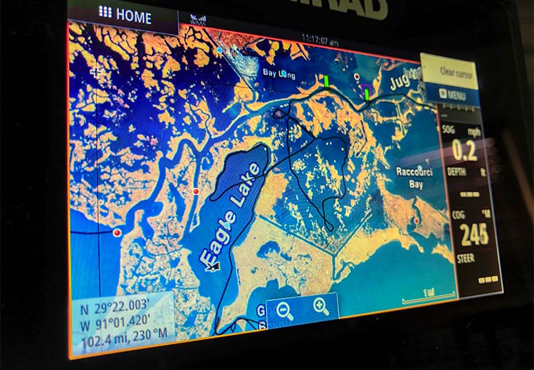
Fancy GPS units like this Simrad didn't exist "back in the day". But they do now, and their capabilities are highly under-utilized by inshore anglers.
modern nautical navigation tools for inshore anglers are a game changer
How we navigate the marsh in the 21st century is a lot different from that of yesteryear. We have these tools at our disposal:
- Powerful GPS
- Mapping Software
- Satellite Imagery
- Mapping Cards
- And More
If you can read maps and use GPS for inshore navigation to their fullest potential, you can go into a brand new area and safely navigate it like a local who has lived there his whole life.
Sure, nothing beats experience, but you can literally shave years off your learning curve and go straight to biting fish if you know what's inside Inshore Fishing 101.
I do, and you will see the proof when watching my Fishing Trip Reviews.
Let me show you how TO use these inshore navigation tools
This blog is organized into categories, and the blog posts above are all about how to read maps and use GPS for inshore navigation.
When you know what I do about these things you will be able to do the following:
I plan on writing more about how to read maps and use GPS for inshore navigation, and the only way I can tell you when a new blog post publishes is if we stay in touch.
You really ought to consider signing up to my email list so you don't miss out.
Tight lines!
- Captain Devin
Note: articles on this website may contain affiliate links, through which the website owner receives some compensation from purchases made.
COPYRIGHT © 2025 LOUISIANA FISHING BLOG, LLC, ALL RIGHTS RESERVED