A bird's eye view - scratch that - astronaut's point of view shows us where river water went the last time Bonnet Carré Spillway was opened.
In my last article about the spillway, I made the point that speckled trout fishing isn't going to be totally hosed this year.
Yes, it's obvious that speckled trout do not thrive in river water, otherwise we'd be catching them next to the French Quarter - which would be kinda cool.
But what's not so obvious is the fishing will still be good, possibly inside Lake Pontchartrain itself.
Maybe even...incredible.
That's what we saw in 2016: record catches of speckled trout and some of the best fishing we've seen in years.
I don't know about you guys, but I'm not ready to throw in the towel by switching up my tackle for redfish and bass.
It's March and I am ready for some speckled trout action! (especially the kind near my home)
So all we really have to do is find where the trout will be, by doing what we always do: finding the Big Three.
And how do we do that? By knowing where the river water will go first.
How do we do this?
By using historical satellite imagery taken before, during and after the spillway opening.
Let's dive into this!
2016 opening of Bonnet Carré Spillway
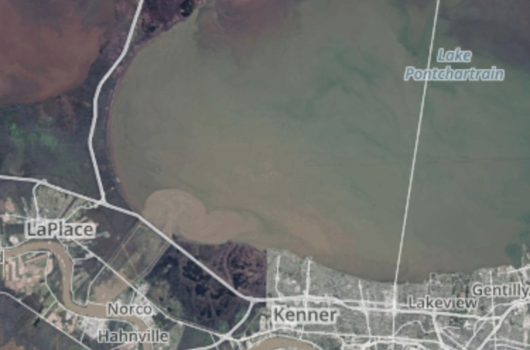
Here is the spillway the day after it was opened on January 11th, 2016.
And here it is again, a week after it opened on January 17th, 2016.
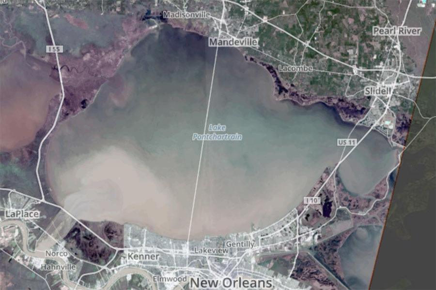
As you can see, river water flows first along the south shore of Lake Pontchartrain, looking almost like a dye marking the tidal flow of the Lake.
The north shoreline remains relatively clean, being influenced more by the Pearl River than the spillway.
Pressing on, this is the lake on March 4th, 2016:
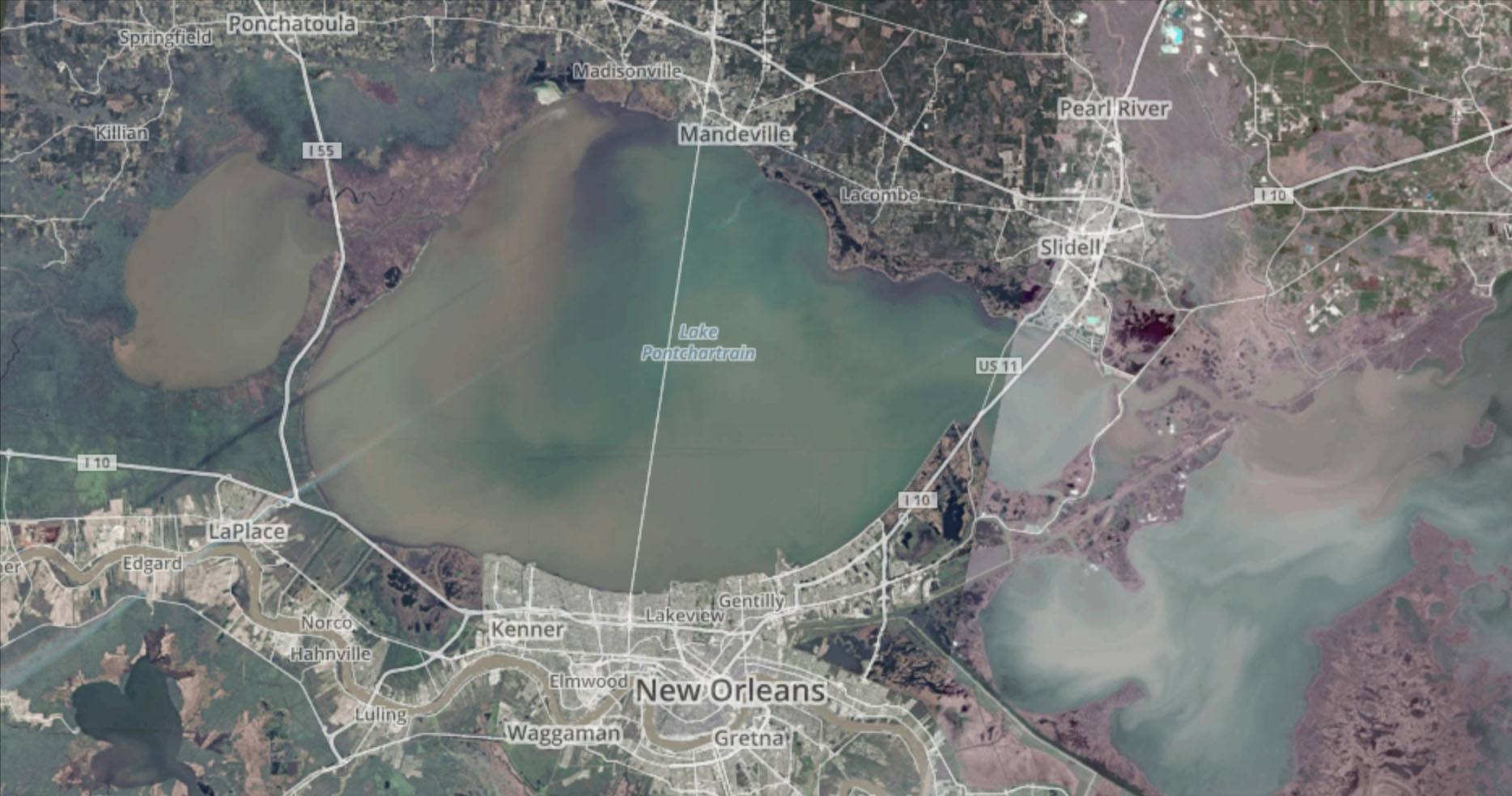
You can see the Lake has a good deal of green in it.
This is because the day of 3/3/2016 experienced a good deal of south and east winds, but it's apparent that river water from the Pearl has penetrated the Rigolets and north shoreline by Treasure Isle.
And trout left in the Lake could have been trapped, if they wanted to leave at all.
We already know that not all fish left the Lake, because LDWF tracked them using acoustic tags.
So knowing that, let's look at Lake Pontchartrain on March 13th, 2016 after northwest winds helped dirty the water and spread the outflow.
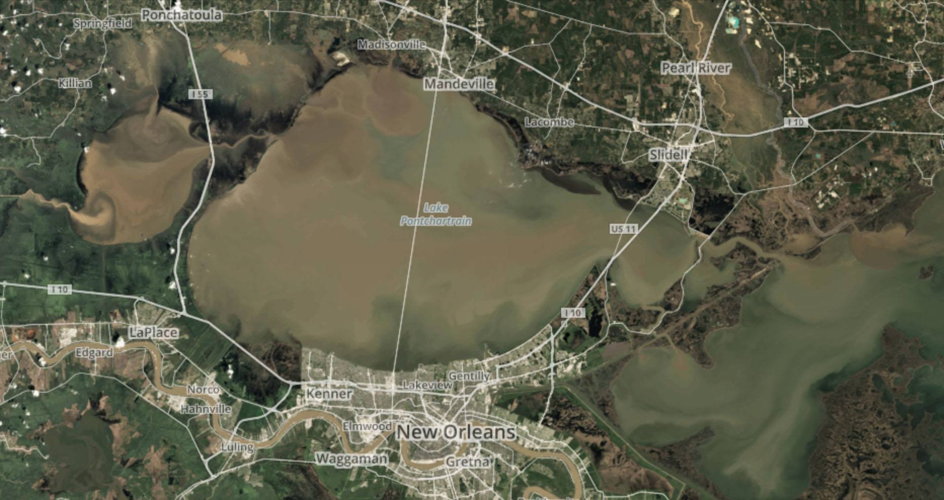
Big difference, isn't it?
Note the clean water pushed out of the marsh by northwest winds on the northern shoreline.
And look at how na-na-nasty the Pearl is! Yuck!
Anyways, let's fast forward. Here is the Lake on October 7th, 2016, just when fall fishing is starting to turn on.
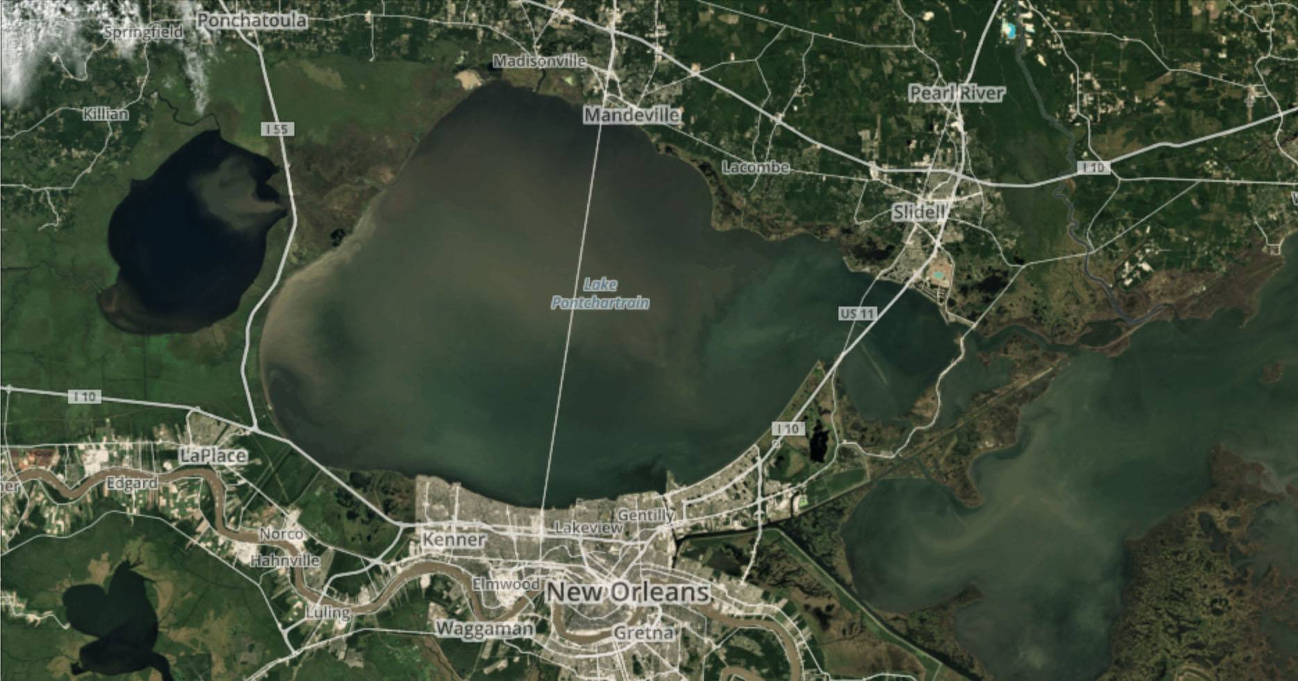
You can see it's pretty green, which is great for trout fishing. The exception is the northern half of the Causeway.
Here it is again on November 25th, 2016:
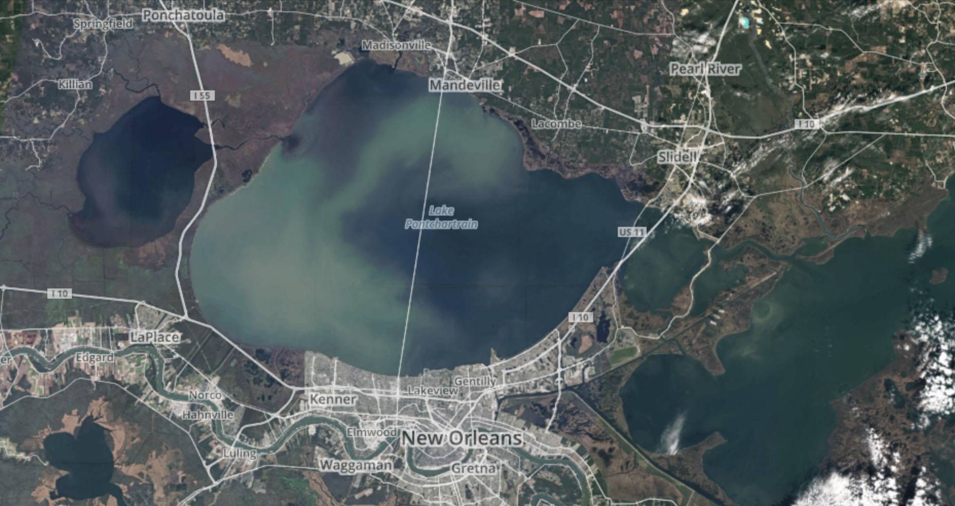
November is arguably one of the best months of the year to fish, and this November was no exception. The clean water is obvious and pales in comparison to previous images.
Conclusion
After reviewing these satellite images, it's clear that the south shore will be the first to go when river water invades Lake Pontchartrain, and that the Pearl River is the Achilles heel in this scenario.
You couldn't know that if you didn't fish "Lake P" regularly, but those who have put their time in are already aware.
It's good to note that the Northshore and eastern side of the Lake will be affected last, sort of like an "Alamo" for fish once the south shore is gone.
But that won't matter if the Pearl starts flooding. Even east winds won't save Lake Pontchartrain, as all they'll do is blow in the Pearl's outflow.
Questions or comments? Scroll down and chime in!

Lance, it’s a fair question, but I think you’re asking it in the wrong place.
You only need to look at LAFB Inshore to see fishing reports for that area, and people have been catching.
That, and you ought to use the search box at the bottom of this page, punch in “high water” and check out the results.
There’s tons of knowledge here.
Mr Devin, this question is also for you.
Hello Scott, how do you think Lake Catherine, Rigolets and Lake Borgne will fare during this high water in the middle of June?
Hey Scott, thanks for commenting.
Honestly, it depends on conditions.
Consider this: take a look at a map and you’ll see that the Bonnet Carre spillway is soooooo far away from the Long Rocks and Bay Eloi, which are both much closer to the actual mouth of the Mississippi River.
Water from the spillway has a long way to go, and a long way out of the way, to get to those locations.
If you see river water mucking up those spots, you’re most likely seeing river water from the south.
How will bay eloi and the rocks fare from the opening